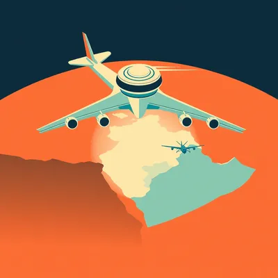
You know Herman, I was looking at a flight tracker the other day, just watching those little yellow icons crawl across the map, and it struck me how invisible the borders are up there. We think of countries as lines on a map, but when you are at thirty-five thousand feet, you are essentially flying through someone else's property, right? It is this strange, silent violation of personal space on a global scale.

Herman Poppleberry, at your service! And you are absolutely right, Corn. It is a three dimensional puzzle of sovereignty. Our housemate Daniel actually sent us a fascinating prompt about this very thing. He was asking about the jurisdiction of airspace, how overflights work in practice, and where the line is between a country's territory and, well, outer space. It is a question that sits at the intersection of physics, high-stakes diplomacy, and some very expensive accounting software.
It is a great question. We have covered aviation from a few angles over the hundreds of episodes we have done, but we have never really sat down to talk about the bureaucracy of the sky. Daniel specifically wanted to know about that altitude limit. Like, if I am in a satellite, am I trespassing? If I am in a high altitude balloon, am I still in France? And if I am in a commercial jet, who am I paying for the privilege of being in their air?
It is one of the most interesting gray areas in international law. And then there is the practical side, how airlines actually manage the fees and approvals for crossing dozens of countries in a single trip. It sounds like a logistical nightmare, but as we will see, it is a highly choreographed dance between humans and software. By the time you finish your first bag of pretzels, your airline has likely already negotiated with three different governments and paid several thousand dollars in "rent" for the air you are breathing.
Let us start with that altitude question. This seems like something that should have a very clear, scientific answer, but I suspect it is more about politics than physics. Where does a country's airspace actually end? If I own a piece of land, do I own the air all the way to the moon?
Historically, there was a legal principle called "Cuius est solum, eius est usque ad coelum," which is Latin for "Whoever owns the soil, it is theirs up to the heavens." But that was written when the highest thing in the sky was a very tall ladder or a particularly ambitious bird. Once we invented the airplane and the satellite, that "up to the heavens" bit became a massive problem. Today, there is no single, universally accepted treaty that defines exactly where airspace ends and outer space begins. However, the most commonly cited boundary is the Karman Line.
The Karman Line. I have heard that mentioned during rocket launches. It is set at one hundred kilometers, or about sixty-two miles, above sea level, right? Why one hundred? Did someone just like the round number, or is there some actual science behind it?
It is a bit of both. Theodore von Karman, a Hungarian American engineer and physicist, was the first to calculate this. He figured out that at around that altitude, the atmosphere becomes so thin that an aircraft would have to fly faster than orbital velocity to derive enough aerodynamic lift from the air to support itself. In other words, at that point, you are not really flying anymore, you are orbiting. You are a spacecraft, not an aircraft. The air is simply too thin to hold you up, no matter how fast your wings are moving.
That makes sense from a physics perspective. If the air can't hold you up, you aren't in the atmosphere. But you mentioned it is not universally accepted. Who disagrees? Because in international law, a disagreement usually means someone is trying to get away with something.
You hit the nail on the head. The United States has historically been the big holdout. The United States Air Force and NASA generally define the edge of space at eighty kilometers, which is exactly fifty miles. They argue that this is the boundary of the mesosphere. If you fly above eighty kilometers in the United States military, you get your astronaut wings. This created a bit of a funny situation during the early days of the Space Shuttle and even with modern commercial spaceflight companies like Virgin Galactic. Depending on which definition you use, their passengers are either "astronauts" or just "very high-altitude tourists."
So if I am eighty-five kilometers above the United States, am I in space according to them, but in their sovereign airspace according to the rest of the world? That seems like a recipe for a diplomatic incident. If a Chinese or Russian satellite were orbiting at eighty-five kilometers, would the U.S. call that a violation of their territory?
In practice, nothing really flies at that "in-between" altitude for very long. Satellites need to be much higher to avoid atmospheric drag. If you try to orbit at eighty-five kilometers, the tiny bit of air that is still there will create enough friction to slow you down, and you will burn up in the atmosphere within a few laps. The lowest stable orbits are usually around one hundred sixty kilometers. Below the Karman Line, you have high altitude balloons and some experimental craft, but for the most part, that space is empty. The real legal weight comes from the Chicago Convention of nineteen forty-four.
Ah, the Chicago Convention. I remember reading that this is basically the constitution of the sky. It was signed while World War Two was still raging, which is wild to think about. They were already planning the post-war world of travel.
Exactly. It established the International Civil Aviation Organization, or ICAO. Article One of that convention states that every state has complete and exclusive sovereignty over the airspace above its territory. But, it never defined how high that airspace goes. The general consensus among legal scholars is that sovereignty extends as far up as an aircraft can functionally fly. Once you are in orbit, you fall under the Outer Space Treaty of nineteen sixty-seven, which says space is the "province of all mankind" and not subject to national appropriation. It is the celestial version of international waters.
So, as long as you are orbiting, you can fly over any country you want without permission. That is why spy satellites are legal, or at least, why you can't really sue someone for having one over your house. But if you are in a plane, you need a hall pass. And that brings us to the second part of Daniel's prompt: how do airlines actually get those hall passes? If you are flying from London to Singapore, you might cross fifteen different countries. Does a pilot have to radio each one and ask, "Hey, can we come in?"
I imagine that would be a bit chaotic, especially with the language barriers and the speed of travel. "Hello, Turkey? This is British Airways, can we use your clouds for twenty minutes?" No, there is a much more robust system, and it is built on what we call the Freedoms of the Air. These are a set of commercial aviation rights granted by one country to another. The first freedom is the most important for this discussion: the right to fly across the territory of another country without landing.
Is that right automatic? Like, if I start Corn Air tomorrow, can I just fly over any country that signed the treaty?
Not quite. Even though most countries are part of the International Air Services Transit Agreement, which grants that first freedom, you still have to file a flight plan. And you almost always have to pay. This is where the overflight fees come in. Every country manages its own Air Traffic Control, or ATC. When an airline uses that service, even if they never touch the ground, they are using the country's infrastructure, their radar, their controllers, their emergency services, and their search and rescue networks. So, the country sends a bill.
I have always wondered how those bills are calculated. Is it a flat fee, or is it like a toll road where you pay by the mile? Because some countries are huge. Crossing Canada or Russia is a lot different than crossing Luxembourg.
It is much more like a toll road, but the math is surprisingly complex. Most countries use a formula that factors in the distance flown and the weight of the aircraft. For example, Eurocontrol, which handles the billing for most of Europe, uses a formula where the fee equals the distance factor times the weight factor times a unit rate. In February of twenty-six, these unit rates vary wildly. A country like Switzerland might have a very high unit rate because their air traffic control is incredibly dense and complex, while a larger, flatter country might be cheaper per mile.
Wait, why the weight of the aircraft? It is not like a heavy plane wears out the air more than a light one. There are no potholes in the sky.
That is a great point, and it is a common question. The logic is twofold. First, heavier aircraft require more complex separation standards and potentially more resources from air traffic control in the event of an emergency. If a Boeing seven seventy-seven has an engine failure, it is a much bigger deal for the local ATC than if a small Cessna has a problem. Second, it is a "value of service" model. A bigger plane carries more passengers and makes more money, so the theory is that the airline can afford to pay more. A Boeing seven seventy-seven is going to pay significantly more to cross Germany than a small private jet.
So, if I am an airline accountant, I am looking at the map and trying to find the cheapest way around. Does that actually happen? Do airlines take longer routes just to avoid expensive airspace?
All the time. It is a constant tug-of-war between fuel costs and overflight fees. This is a massive part of a flight dispatcher's job. Some countries are notorious for having high fees. Russia, for instance, has historically charged very high "Siberian overflight" royalties for European airlines flying to Asia. Since the geopolitical shifts of the last few years, most Western airlines are completely banned from Russian airspace anyway, which has forced them to fly much longer routes over the North Pole or through the Middle East. This adds hours to the flight and thousands of gallons to the fuel burn.
That is a perfect example of airspace as a weapon. If you can't fly over a country, you are at a massive disadvantage. But let's get into the mechanics of it. Daniel asked if this process is fully automated. When a flight is being planned, is there a person sitting there looking at a map of fees, or is a computer doing the heavy lifting?
It is a bit of both, but the automation is incredibly sophisticated. This is where the flight dispatcher comes in. This is a role Daniel mentioned, and it is one of the most underrated jobs in aviation. People know about pilots and air traffic controllers, but the dispatcher is the one who actually builds the "bridge" for the flight. In the United States, under FAA rules, the dispatcher and the pilot-in-command share joint responsibility for the safety of the flight. If the plane crashes because it ran out of fuel, the dispatcher can lose their license just like the pilot.
I have seen pictures of those airline operations centers. They look like NASA Mission Control. Tons of screens, weather maps, and people in headsets. What is the dispatcher actually doing when they "handle" an overflight?
Think of the dispatcher as the flight's co-manager on the ground. Before the plane even leaves the gate, the dispatcher is using flight planning software like Sabre, Lido, or NAVBLUE. This software has a massive database of every airway, every restricted zone, every overflight fee, and every current weather report in the world. The dispatcher inputs the destination, and the software generates several optimized routes. One might be the fastest, one might be the most fuel efficient, and one might be the cheapest in terms of overflight fees.
So the software suggests the route, but the dispatcher has to sign off on it. Why do we still need the human in that loop if the computer is so smart?
Because software is great at math but sometimes bad at context. A dispatcher might see a "NOTAM"—that stands for Notice to Air Missions—that says a specific radar station in a country is down, or there is a sudden volcanic ash cloud, or maybe the diplomatic relations between the airline's home country and a country on the route just soured. For example, if you are an airline based in the Middle East, your dispatcher has to be hyper-aware of which countries are currently allowing you to use their air. They also have to calculate "ETOPS" requirements—that is Extended-range Twin-engine Operational Performance Standards. If you are flying over the ocean or a remote desert, the dispatcher has to ensure that at any given point, the plane is within a certain flying time of an "alternate" airport where they have permission to land.
So, once they agree on a route that crosses, say, ten countries, what happens next? Does the dispatcher have to send ten different emails?
Thankfully, no. Most of this is handled through the SITA or ARINC networks, which are basically the private, highly secure internet of the aviation world. The flight plan is filed electronically. For Europe, it goes to Eurocontrol's central system. For other regions, it goes to the relevant national aviation authorities. In most cases, if the airline has a pre-existing agreement and the flight plan follows established airways, the approval is almost instantaneous and automated. The system checks the flight plan against restricted areas and traffic flow, and if it fits, it sends back an "ACK" or acknowledgment.
But what about countries that don't have those "open" agreements? I remember hearing that some flights require "diplomatic clearance."
You are thinking of military or state flights. If a government plane or a military transport wants to fly over another country, that usually requires a formal diplomatic note sent through embassies weeks in advance. But for commercial airlines, it is much more streamlined. However, there are still "Prior Permission Required" or PPR zones. If an airline wants to fly a new route or if there is a temporary restriction, the dispatcher might indeed have to get on the phone or send a specific request to a Civil Aviation Authority. During the height of the global tensions we have seen recently, dispatchers have had to become experts in international relations just to get a flight from New York to Delhi.
This is where it gets interesting to me. We are talking about thousands of flights a day. The sheer volume of data being exchanged to ensure that every plane has permission to be where it is... it is mind boggling. And then there is the billing. Does the country just send an invoice to the airline at the end of the month? "Dear Delta, you owe us for twelve thousand miles of air. Please pay by the fifteenth."
That is exactly how it works! It is like a monthly utility bill. Eurocontrol, for example, acts as a central billing office for its forty-one member states. They track every flight using radar and ADS-B data—that is Automatic Dependent Surveillance-Broadcast, where the plane tells the ground exactly where it is via satellite. They calculate the fees based on the actual track the plane flew, not just the planned route. At the end of the month, they send one big bill to the airline. The airline pays Eurocontrol, and Eurocontrol distributes the money to the individual countries. For countries outside of these big blocks, airlines often use agencies like IATA's Currency Clearance Service or private companies that specialize in "overflight management."
It sounds like a very efficient system, but it also seems fragile. What happens when a country suddenly closes its airspace? We saw this with the Qatar blockade a few years ago, and more recently with the closures over Eastern Europe.
It is a logistical nightmare. If a country closes its airspace while a plane is already in the air, the dispatcher has to find a new route immediately. This is where the "human in the loop" becomes vital. They have to calculate if the plane has enough extra fuel to take a longer path. If they don't, the dispatcher has to coordinate an emergency landing at an intermediate airport. This happened frequently in early twenty-two when the airspace over Ukraine and parts of Russia closed. Flights were literally turning around mid-air or diverting to Turkey and Kazakhstan to refuel because their original paths were suddenly "forbidden."
I want to go back to the fee structure for a second. You mentioned it is based on weight and distance. Are there any countries where it is actually free to fly over? Or is every square inch of the sky monetized?
Very few places are free. Even small island nations in the Pacific charge overflight fees for the vast tracts of ocean they control. These are called Flight Information Regions, or FIRs. If you are flying from Los Angeles to Sydney, you are crossing through various FIRs managed by countries like Kiribati or Fiji. They provide the radio relay and search and rescue coordination, and they charge for it. Even though you are over the middle of the ocean, someone is watching you on a screen and making sure you don't hit anyone else.
It is interesting that even the middle of the ocean has a "landlord." It makes the world feel very small.
It really does. And the fees aren't just for the government's pocket. They are supposed to be reinvested into the aviation infrastructure. Better radar, better training for controllers, safer skies. In the United States, the FAA is funded largely by these types of taxes and fees. In other countries, like Canada, the air traffic control system is actually a private, non-profit corporation called Nav Canada, which is funded entirely by these overflight and landing fees. They don't get a dime of government tax money.
I imagine the transition to satellite-based navigation and tracking is changing this whole landscape. If we don't need ground-based radar as much, does the justification for the fees change? If I am using a GPS satellite and my own onboard ADS-B to navigate, why am I paying a country for "using their radar" that they might not even have?
That is a massive debate happening right now. With systems like Space-based ADS-B, companies like Aireon are providing global tracking via the Iridium satellite constellation. Some airlines argue that if the country isn't providing the physical radar hardware, the fee should be lower. But the countries counter that they are still providing the legal framework, the human air traffic controllers who manage the traffic flow, and the emergency coordination. The "service" isn't just the radar ping; it is the management of the space to ensure two planes don't try to occupy the same coordinates at the same time.
It is like paying for a road even if you are driving a hovercraft that doesn't touch the pavement. You are still using the "right of way" that the state maintains and polices.
That is a perfect analogy. And as we move toward more autonomous flight and higher traffic density, that management becomes even more critical. We are moving toward "Trajectory Based Operations," or TBO. This is the future Daniel was asking about. Instead of a dispatcher filing a plan and waiting for a "yes," the airline's computer and the regional ATC computers will basically "handshake" and agree on a precise four-dimensional path—latitude, longitude, altitude, and time.
So, instead of "stay on this airway at thirty-six thousand feet," the system says "be at this exact point at exactly fourteen-twenty-two and four seconds."
Exactly. It will be like a high-speed trading algorithm, but for airplanes. The human dispatcher will still be there to handle the "black swan" events—the things the computer can't predict, like a medical emergency on board or a sudden microburst of wind—but the day-to-day overflight management will be almost entirely silent and invisible. We are already seeing this with "Free Route Airspace" in Europe, where planes don't have to follow fixed "highways" in the sky anymore. They can fly the most direct path possible, and the computers just make sure they don't cross paths.
It is fascinating how much goes on behind the scenes of a simple flight. You just buy a ticket, sit in your seat, and maybe complain about the legroom, while down on the ground, dispatchers and algorithms are negotiating with ten different governments just so you can fly over them. It is a miracle of cooperation, honestly.
It really is. Despite all the wars and political bickering on the ground, the sky is one of the most coordinated places on Earth. The fact that a plane can fly from New York to Dubai and cross through a dozen different jurisdictions without a single hiccup is a testament to the systems we have built. It is a global "gentleman's agreement" backed by some of the most advanced technology humanity has ever created.
So, to summarize for Daniel, the "limit" of a country's sovereignty is generally the Karman Line at one hundred kilometers, though the U.S. likes to play by its own fifty-mile rule. Overflights are managed through a mix of international treaties like the Chicago Convention, sophisticated flight planning software like Lido or Sabre, and the watchful eye of the flight dispatcher. And yes, it is mostly automated, but the "mostly" is where the human expertise really matters when things go wrong.
Spot on. And it is all funded by a complex system of tolls that keep the lights on in air traffic control centers from Fiji to Frankfurt. It is a massive, invisible economy that exists entirely above our heads.
I think we have covered a lot of ground, or air, today. It is one of those topics that seems dry on the surface—bureaucracy and fees—but it is actually the story of how we managed to turn the entire planet into a single, reachable neighborhood.
I totally agree. It is the invisible infrastructure of our modern world. If you found this dive into the bureaucracy of the clouds interesting, we would really love it if you could leave us a review on your podcast app. It honestly helps other curious people find the show.
Yeah, a quick rating on Spotify or Apple Podcasts makes a huge difference. And if you have your own "weird prompt" about aviation, or physics, or how the world works, head over to myweirdprompts.com and send it our way. We have a contact form there, and we love hearing from you all.
We really do. This has been My Weird Prompts. I am Herman Poppleberry.
And I am Corn. Thanks for listening, and we will talk to you in the next one.
Goodbye!

")