Welcome back everyone to My Weird Prompts. I am Corn, and I am joined as always by my brother.

Herman Poppleberry, at your service. It is great to be back in the studio, though calling our living room a studio might be a bit of a stretch.
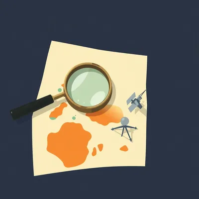
Hey, we have some high quality foam on the walls now. That counts for something. But today we have a topic that hits close to home, literally. Our housemate Daniel sent us a prompt about something happening right above our heads here in Jerusalem. We are talking about satellite imaging, specifically the regulations around how clearly the rest of the world can see what is happening on the ground in Israel.
This is one of those topics where technology, international law, and national security all collide in a very messy and fascinating way. For decades, there was this invisible bubble over Israel that essentially blurred out the details for anyone looking from space. But that bubble has been popping lately, and the implications are massive.
It is funny because when we think of satellites, we often think of them as these neutral observers, just taking pictures of the Earth. But the clarity of those pictures is actually a major diplomatic lever. Daniel mentioned the Kyl-Bingaman Amendment, which I think is where we really have to start if we want to understand why things are changing now.
Absolutely. The Kyl-Bingaman Amendment is the foundation of this entire discussion. It was passed by the United States Congress back in nineteen ninety-seven. To give you some context, that was the very early days of commercial satellite imaging. Before then, if you wanted a high resolution photo of the Earth from space, you pretty much had to be the Central Intelligence Agency or the Kremlin. But as private companies started getting into the game, Israel became very concerned about its security.
Right, because if a private company can sell a high resolution photo of a sensitive military base or a power plant to anyone with a credit card, the traditional concept of military secrecy just evaporates. So the United States, being Israel's primary strategic partner, stepped in to help.
Exactly. Senators Jon Kyl and Jeff Bingaman introduced this amendment to the National Defense Authorization Act. It basically said that the United States government would not license any American company to collect or distribute satellite imagery of Israel that was more detailed than what was already available from foreign commercial sources.
And for a long time, that limit was set at two meters. Which, when you think about it, is actually quite blurry.
It is very blurry. At two meters per pixel, a car is just a little smudge. You can see a building, but you cannot see the doors or windows. You can see a road, but you cannot see the individual lanes clearly. It was enough to see general geography, but not enough for tactical planning or identifying specific pieces of equipment.
But this created a weird situation for over twenty years. If you looked at Google Earth, you could see the individual tiles on a roof in New York or Paris, but when you scrolled over to Tel Aviv or Jerusalem, everything suddenly got pixelated. It looked like the internet was lagging, but it was actually federal law.
That is a great way to put it. It was a legal lag. But the problem with the Kyl-Bingaman Amendment was that it was based on the idea that the United States could control the global market. In nineteen ninety-seven, that was mostly true. American companies like DigitalGlobe, which is now part of Maxar, were the leaders. But as the years went by, other countries started launching their own high resolution satellites.
This is where the whole policing aspect comes in, which Daniel asked about. Is it even possible to police who gets this imagery anymore? Because if a French company or a South Korean company is selling half-meter imagery of Israel, then the American law is not protecting Israel's secrets, it is just hurting American businesses.
That is exactly what happened. By the late twenty-tens, companies like Airbus in Europe with their Pleiades satellites and even the Israeli company ImageSat International were offering imagery that was much, much better than two meters. They were hitting fifty centimeters or even lower. So the United States Department of Commerce finally had to admit that the foreign availability of high resolution imagery of Israel had surpassed the two-meter limit. It became impossible to police because the U.S. no longer held a monopoly on the high ground.
So in July of twenty-twenty, they finally relaxed the regulation. They moved the limit from two meters down to zero point four meters, or forty centimeters. That is a five-fold increase in resolution.
It is actually even more significant than that when you think about the area. Since resolution is measured in linear distance, a five-fold increase in resolution means you have twenty-five times more pixels in the same area. The jump from two meters to forty centimeters is like going from an old cathode ray tube television to a modern high definition screen.
I want to dig into that technical side for a second, because Daniel brought up the term Ground Sample Distance, or GSD. I think people hear that and think it just means resolution, but there is a nuance there, right?
There is. Ground Sample Distance is the technical way we measure the spatial resolution of a digital image taken from space. It represents the distance between the centers of two adjacent pixels as measured on the ground. So if a satellite has a GSD of forty centimeters, it means each pixel in the image represents a forty-by-forty centimeter square on the Earth's surface.
Okay, so if I am standing on the ground and I have a forty centimeter GSD satellite looking at me, I am basically just a couple of pixels.
Exactly. You would be a small blob. But the difference between forty centimeters and thirty centimeters, which is the current commercial maximum, is where things get really interesting. Daniel asked what the actual difference in clarity is between zero point four meters and zero point three meters. On paper, it is only ten centimeters. It sounds like nothing.
Yeah, ten centimeters is the length of a smartphone. How much more can you really see?
It turns out, quite a bit. In the world of image analysis, we use something called the National Imagery Interpretability Rating Scale, or NIIRS. Those ten centimeters are often the difference between detection and identification. At forty centimeters, you can see a vehicle and you can probably tell it is a truck rather than a car. But at thirty centimeters, you can start to tell what kind of truck it is. You can see the difference between a civilian delivery truck and a military transport vehicle. You can see hatch patterns on armored vehicles. You can see the specific shape of a radar antenna.
So it is about the level of intelligence you can extract. If I am an analyst looking at forty centimeter imagery of an Israeli airbase, I can see that there are planes on the tarmac. But at thirty centimeters, I can tell if those planes are F-sixteens or F-thirty-fives.
Precisely. And that is why the jump to zero point four meters was such a big deal for Israel. Suddenly, things that were hidden by the graininess of the image were now visible to anyone with a few thousand dollars to buy a satellite pass. It changes the entire security calculus. Israel has always relied on ambiguity and secrecy as a deterrent. When you are a small country, you do not want your enemies knowing exactly where every battery of Iron Dome is located or which hangars are occupied.
It feels like the naked country analogy Daniel used is very apt. It is like the airport scanners that can see through clothes. Once the resolution gets high enough, the traditional ways of hiding things—like putting a tarp over something or building a wall—stop working as well because the sensors are so sensitive.
And it is not just visible light anymore. We have talked about synthetic aperture radar and multispectral imaging in past episodes. But even just sticking to the optical side, the level of detail we are reaching is pushing the boundaries of physics.
Which brings us to the big question everyone always asks. Can they see my license plate? Can they see my face? We see this in movies all the time. The hero is in a crowded square, and the guy in the van says, enhance, and suddenly we can see the wedding ring on the target's finger. Is that real, Herman? Or is that just Hollywood?
I hate to be the bearer of boring news, but that is almost entirely Hollywood. There is a fundamental limit in physics called the diffraction limit. Basically, the size of the telescope's aperture determines the maximum resolution it can achieve from a certain altitude. To see a license plate from an altitude of five hundred kilometers, which is where most low Earth orbit satellites live, you would need a telescope with a mirror that is tens of meters wide.
For reference, the Hubble Space Telescope's mirror is two point four meters wide. And that is about as big as we can reasonably launch and operate right now.
Exactly. The most advanced spy satellites, like the Keyhole series operated by the United States, are rumored to have mirrors similar in size to Hubble's. Even with those, you are looking at a resolution of maybe five to ten centimeters. That is incredible. You could see a basketball on the ground. But a license plate is about twelve inches wide, and the letters on it are much smaller. To read those letters, you would need sub-centimeter resolution. We are nowhere near that from space.
What about faces? If I look up at a satellite and wave, can they see my expression?
No. At ten centimeters, your head is basically one pixel. You would just be a flesh-colored dot. You cannot see eyes, you cannot see hair color clearly, and you certainly cannot use facial recognition. The atmosphere is also a huge factor. The air is constantly moving and shimmering, which distorts the light. Even if you had a perfect telescope, the atmosphere would still blur the image at that level of detail.
So when Daniel asks if the ultra-high resolution allows for seeing license plates or faces, the answer is a pretty firm no for current technology. But that does not mean the risk is low. If I cannot see your face, I can still see your car. And if I can see your car, I can follow you home. I can see your patterns of life.
That is the real danger. It is not about identifying an individual in a single photo; it is about persistent surveillance. Companies like Planet Labs have hundreds of small satellites in orbit. They can take a picture of the same spot on Earth every single day. If you have thirty or forty centimeter imagery every day, you can track the movement of every ship in a harbor, every tank in a division, and every plane on an airfield. You can see construction starting on a new bunker before the first brick is laid.
And that is why the rollback of the Kyl-Bingaman Amendment was so controversial in the Israeli defense community. They knew that once the genie was out of the bottle, there was no going back. The US government realized they could not stop other countries from providing this data, so they might as well let American companies compete. But for Israel, it meant a permanent loss of a certain kind of privacy.
It is a classic example of technology outrunning policy. You can pass all the laws you want, but if the capability exists and there is a market for it, someone is going to provide it. The US-Israel relationship is incredibly strong, but even that relationship has to bend to the reality of the global commercial space market.
I think it is also worth noting how this affects the average person. We tend to think of this as a military-to-military thing. But NGOs, journalists, and even amateur researchers now have access to this stuff. We saw this with the conflict in Ukraine and more recently with tensions in the North. Open source intelligence, or OSINT, has become a massive field.
It is a total democratization of intelligence. Twenty years ago, if you wanted to prove a country was building a secret nuclear facility, you needed a defector or a spy. Today, you just need a subscription to a satellite imagery provider and a lot of patience to look through the frames. This transparency can be a good thing—it makes it harder for governments to lie about what they are doing. But it also makes the world a much more transparent and, in some ways, more dangerous place.
Let's talk about the specific risks for Israel with this change to zero point four meters. When you have a country as small as this one, there is no strategic depth. Everything is close to everything else. If you can see the exact layout of a base in the Negev, you can plan a strike with incredible precision.
That is the nightmare scenario. Precision-guided munitions rely on accurate coordinates. If your satellite imagery is off by two meters, your missile might miss the target. If it is accurate to forty centimeters, you can put that missile right through the front door. Israel has had to invest heavily in deception and underground facilities to counter this.
We have actually seen some of that in recent reports. Daniel mentioned preparations for war and deception in Iran. It is a constant game of cat and mouse. You know the satellite is coming over at ten a.m., so you move the trucks under a canopy at nine fifty-five. Or you paint fake planes on the tarmac.
The fake planes are a classic! We have seen satellite images of Iranian airbases where they have painted F-sixteens on the ground. But the high resolution imagery actually makes that harder to pull off. At two meters, a painting looks like a plane. At forty centimeters, an analyst can see that the plane has no shadow, or that the paint is reflecting light differently than metal would. The higher the resolution, the more sophisticated the deception has to be.
It is amazing to think that a few centimeters of resolution can change the entire defense strategy of a nation. It makes me wonder where the limit is. If thirty centimeters is the commercial max right now, what is next? Are we going to see twenty centimeters? Ten?
We are already seeing companies pushing for it. Maxar's WorldView Legion constellation and the latest Airbus Neo satellites are pushing right up against that thirty centimeter limit with incredible revisit rates. The main barrier now is not just the mirrors, but the processing power and the data downlink. Taking a thirty centimeter image of the entire Earth every day generates a staggering amount of data. You have to be able to get that data down to the ground and process it quickly. But with the advent of edge computing on satellites and better laser communications, those bottlenecks are disappearing.
And then you add artificial intelligence into the mix. You might not have the resolution to see a license plate, but an AI can look at the blurry shape of a car and compare it to millions of other images to tell you with ninety-nine percent certainty that it is a twenty-twenty-two Toyota Hilux with a specific modification.
That is the "enhance" button of the future. It is not about magically creating pixels that are not there; it is about using machine learning to infer what is most likely there based on patterns. It is called super-resolution. It can take a forty centimeter image and make it look like a twenty centimeter image. It is not perfect, but for an intelligence analyst, it is a game changer.
It really does feel like we are entering an era of radical transparency. And as we live here in Jerusalem, it is a bit surreal to think that at any given moment, there are dozens of lenses pointed down at us, capable of seeing if we have our laundry out on the balcony.
Well, if they are looking at our laundry, they are going to see a lot of black t-shirts. But you are right. The sense of being watched is no longer a paranoid fantasy; it is a technical reality. For a country like Israel, which has always survived on its wits and its secrets, this shift is profound. The rollback of Kyl-Bingaman was the official recognition that the era of hiding from space is over.
I think this is a good spot to take a quick breather. When we come back, I want to talk about the practical takeaways. What does this mean for the future of conflict in our region? And how does a country like Israel adapt when its borders are essentially transparent?
And I have some interesting data on how other countries in the region are reacting to this. It is not just a US-Israel story anymore.
We will be right back.
Alright, we are back. We have been diving deep into the world of satellite resolution and the end of the two-meter era over Israel. Herman, before the break, you mentioned that other countries in the Middle East are reacting to this transparency. It is not just about what the US allows anymore.
Not at all. In fact, we are seeing a massive space race in the Middle East. Countries like the United Arab Emirates and Saudi Arabia are launching their own high resolution imaging satellites. The UAE's Falcon Eye satellites, which were built in collaboration with French companies, have a resolution of around seventy centimeters. They do not have to ask the US for permission to look at Israel, or anywhere else for that matter.
So the Kyl-Bingaman Amendment was really a relic of a unipolar world. Once France, Russia, China, and India all had high resolution commercial capabilities, the US law was basically a screen door in a hurricane.
Exactly. And that is why the rollback in twenty-twenty was so inevitable. But the practical takeaway for Israel is that they have had to shift from a strategy of concealment to a strategy of resilience. If you cannot hide what you have, you have to make sure that knowing what you have does not give the enemy a decisive advantage.
That sounds like a tall order. If I know exactly where your missile silos are, how do you stop me from hitting them?
You make them mobile. You make them redundant. You build them so deep that even a precise hit cannot take them out. Or, you use active defenses like the Arrow system or David's Sling. The irony is that as satellite imagery makes the world more transparent, it also makes the world more automated. If you can see a threat developing in real time from space, you need an automated system to respond to it before the window of opportunity closes.
It also changes the nature of diplomacy. We have seen this with the reports about Iran that Daniel mentioned. When one country can show the world a high resolution image of another country's military preparations, it becomes a form of "naming and shaming." You cannot hide behind denials when there is a forty centimeter picture of your new missile gantry on the front page of the New York Times.
It is a powerful tool for preventing conflict, but it can also be used to provoke it. Misinterpretation of satellite imagery is a huge risk. Remember the "mobile labs" in Iraq? Those were based on interpretations of satellite photos that turned out to be wrong. At forty centimeters, you have a lot more detail, but you still do not have the context. You see a truck at a warehouse. Is it delivering food or chemicals for a weapon? The image cannot tell you that.
That is an incisive point, Herman. The higher the resolution, the more we think we understand, which might actually make us more prone to overconfidence in our intelligence. We see a clear picture and think we see the truth, but we are still just seeing a snapshot in time.
Precisely. And for the average person listening to this, the takeaway is that your privacy is increasingly a matter of policy rather than physics. The technology to see almost anything is there. Whether or not it is used, and who is allowed to see it, depends on the laws we pass and the agreements countries make.
It also means that for those of us living in "high interest" areas, the concept of a private backyard is becoming a bit of a myth. If you are doing something outside, you have to assume there is a record of it somewhere in a database in Northern Virginia or Toulouse.
It is a bit sobering, isn't it? But it is also incredibly cool from a scientific perspective. We are living in an age where we can monitor the health of every forest on the planet, track the melting of every glacier, and see the growth of every city in real time. The same technology that makes a country "naked" also makes our planet more understandable.
I think that is the dual nature of almost all the weird prompts Daniel sends us. There is always a dark side and a light side. The same forty centimeter resolution that can guide a missile can also help a rescue team find survivors after an earthquake or help a farmer optimize their crop yield.
I agree. And as we move forward, the challenge will be managing that balance. Israel is the test case for this. How does a modern, high-tech nation maintain its security in an era of total transparency? We are watching the answer play out every day right here.
Well, Herman Poppleberry, I think we have covered the ground on this one. From the halls of Congress in nineteen ninety-seven to the cutting-edge satellites orbiting us right now.
It has been a trip. And I hope we cleared up the license plate myth for Daniel. Sorry, Daniel, you still cannot read the fine print from five hundred miles up.
Not yet, anyway. Maybe in Episode one thousand we will be talking about sub-centimeter resolution.
If we are still doing this in Episode one thousand, I think our housemate will have run out of prompts by then.
Knowing Daniel, I highly doubt that. Before we wrap up, I want to say a huge thank you to all of you for listening. We have been doing My Weird Prompts for a long time now, and the community that has grown around these deep dives is just incredible.
It really is. We love seeing your comments and hearing your own theories on these topics. If you are enjoying the show and you want to help us reach more people, please take a second to leave us a review on your favorite podcast app or on Spotify. It genuinely makes a huge difference in helping new listeners find us.
Yeah, it is the best way to support the show. You can also find all our past episodes and a way to get in touch with us at our website, myweirdprompts.com. We have a full archive there, and if you have a prompt of your own that you want us to tackle, that is the place to send it.
We are also on Spotify, so make sure to follow us there so you never miss an episode. This has been a fascinating look at the eyes in the sky over Israel.
Thanks for joining us for Episode five hundred and fifty-nine. We will see you next time on My Weird Prompts.
Goodbye everyone! Stay curious.
Bye.

")