#satellite-imagery
29 episodes

#3780: How Open-Source Satellites Spot Missile Launches
Thermal satellite data you can access for free can detect missile plumes. Here's what that tells us about classified military capabilities.
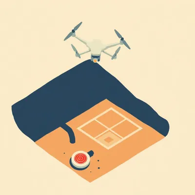
#3641: Archaeology’s Ray Gun Era: Drones, LiDAR & AI on Digs
Drones, ground-penetrating radar, and AI are transforming archaeology. The fine brush is just 5% of the story.

#3623: How to Hide an Airbase in Plain Sight
From secret Israeli desert runways to modern camouflage — how militaries hide airstrips from satellites.
#3383: How the IAEA Watches Iran When the Door Is Locked
Iran has locked out inspectors. Here's how the IAEA still tracks its nuclear program through forensic evidence and satellite imagery.

#3162: Sovereign SATCOM: Inside the Military's Orbital Arms Race
Why the US, Russia, and China each build their own military satellite networks — and how WGS, Blagovest, and Tiantong compare.
#3133: How China Built 350+ Nuclear Silos in 5 Years
Satellite imagery reveals China's rapid nuclear buildup—350+ silos since 2021 and a fivefold warhead increase in 16 years.

#2724: How Sanctions Actually Trap a Company
How the US Treasury freezes assets, isolates firms, and makes the world enforce its rules.

#2448: Who Gets the Bandwidth at Sea
How packet-level bonding and QoS keep thousands of passengers streaming while navigation systems stay safe.

#2402: Geospatial Gold Rush: Who's Hiring Satellite Sleuths?
From crop health to cargo routes, discover which industries are paying top dollar for geospatial analysis skills—and the tools they use daily.

#2032: Jerusalem's Skyscrapers Are Just Holograms
A producer claims Jerusalem's new towers aren't built—just light projected onto scaffolding to fool investors.
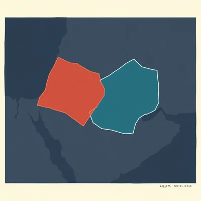
#1974: When Ancient Borders Refuse to Stay Still
Using satellite maps and ancient texts, we trace the shifting boundaries of the biblical Land of Israel from the River of Egypt to the Euphrates.
#1844: How Amateurs Track Spy Satellites with Laptops
Forget Langley—these hobbyists spot classified satellites from their backyards using math, cheap cameras, and public data.

#1790: The Paradox of Hyper-Visible Isolation
Satellite imagery maps the Amazon while tribes choose to remain isolated. Discover the truth behind the "Stone Age" myth and the threats they face.
#1531: Nowhere to Hide: The Global Rise of OSINT
From flight trackers to satellite radar, discover how the OSINT community is dismantling military secrecy and redefining the modern battlefield.

#1497: Is Your Company Actually Profitable or Just a Value Destroyer?
Is profit a fiction? Discover how new accounting standards are pricing air, water, and life itself directly into the corporate balance sheet.

#1433: The End of Secret Eyes: How Satellite Data Became a Public Utility
Forget spy movies. Discover how modern satellites track sinking cities, methane leaks, and the "pulse" of our changing planet in real time.

#1306: The Psychology of Hidden Places
Think you’ve seen all of Israel? Explore the "blind spots" of the map and the hidden micro-geographies that tourists and locals overlook.

#1181: Can North Korea Survive High-Resolution Reality?
In an age of high-res satellites and digital leaks, the world’s most reclusive state is becoming its most transparent.

#1092: The Landscape Reader: Geolocation Beyond Metadata
Master the art of geolocation by reading physical clues like vegetation, shadows, and road markings—no metadata required.

#1000: The Collective Consciousness That Catches a Bullet
Explore how the Green Pine radar and multi-source data fusion power the high-stakes world of hypersonic missile defense.

#927: That Others May Live: The Mechanics of Combat Rescue
After a friendly fire incident in Kuwait, six airmen were rescued in record time. Discover the systems that ensure no one is left behind.

#905: The 3 AM Siren: The Science of Nighttime Missile Attacks
Why do sirens always wail at 3 AM? Discover the high-stakes game of orbital mechanics and satellite blind spots behind nighttime missile strikes.

#836: Two Miles to Tomorrow: Life on the Bering Strait
Discover the tiny islands where the US and Russia are just two miles apart—and separated by an incredible 21-hour time difference.

#821: The Pattern Seekers: Autism in Global Intelligence
Why are elite intelligence units recruiting autistic analysts? Explore the intersection of neurodiversity, AI, and national security.