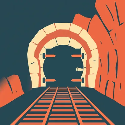
Every ceasefire draft between Israel and Hezbollah names the Litani River as the dividing line. And yet, nearly twenty years after Resolution 1701, Hezbollah still operates south of it. Tunnels, rocket caches, observation posts — the whole apparatus. So the question Daniel sent us is the right one: what is the river actually doing? And why does this particular valley, the Beqaa, keep showing up as the real problem nobody can solve?

The Beqaa Valley is the part most ceasefire coverage misses entirely. Everyone fixates on the border region, the thirty-kilometer buffer, the UNIFIL patrols. But the Beqaa is where the weapons enter the country, where the manufacturing happens, where the command structure lives. It's Hezbollah's logistical spine, and if a ceasefire doesn't address it, you're signing a document that has an expiration date baked into the ink.
That's what we're unpacking today. The geography, the military logic, and why the Litani River became this totemic line in diplomatic language — even after the rockets that made it strategically irrelevant started arriving by the truckload.
We're watching this play out right now. Israeli airstrikes hit weapons depots near Baalbek in the northern Beqaa just this past February. The pattern is: ceasefire talks happen, Hezbollah restocks through the Beqaa, Israel strikes the Beqaa, talks resume. Round and round.
Let's start with the two pieces of geography that anchor this whole discussion. The Litani River and the Beqaa Valley. Herman, paint the map for us.
The Litani is Lebanon's longest river — roughly a hundred and seventy kilometers, flowing west and then south, emptying into the Mediterranean just north of Tyre. At its closest point, it runs about thirty kilometers from the Israeli border. That thirty-kilometer figure is the entire strategic logic. In 2006, when the UN passed Resolution 1701, the idea was straightforward: push Hezbollah north of the Litani, and Israel's northern towns are out of range of the short-range Katyusha rockets Hezbollah was firing. Those max out around twenty kilometers. So thirty kilometers gave you a buffer.
A long, fertile valley running north-south between the Mount Lebanon range on the west and the Anti-Lebanon mountains on the east, which form the border with Syria. About a hundred and twenty kilometers long, and the key detail is the Masnaa border crossing in the east. That's the main entry point for goods and, critically, weapons coming from Syria. The Damascus-Beirut highway runs right through it. If you're Iran and you want to arm Hezbollah, you fly materiel into Damascus, truck it across the border at Masnaa, and it disappears into the Beqaa.
You've got these two features — a river in the south that was supposed to be a buffer, and a valley in the east that functions as a supply artery. And the core puzzle of Resolution 1701 is that it only addressed one of them.
1701 demanded all armed forces south of the Litani be Hezbollah-free — only the Lebanese army and UNIFIL peacekeepers present. It said nothing about the Beqaa. It couldn't. UNIFIL's mandate is explicitly limited to the area south of the Litani River. The Beqaa is entirely outside its patrol zone.
Which means the resolution created a safe zone for Hezbollah — just not the one anyone intended.
Hezbollah can rebuild and rearm in the Beqaa with zero international monitoring, and the Lebanese army lacks both the will and the capacity to disarm them there. So you have this bizarre situation where a ceasefire is in effect, UNIFIL is patrolling the south, and meanwhile weapons are flowing through the Beqaa unimpeded. The river becomes a line on a diplomatic document, not a barrier.
That's the paradox Daniel's question gets at. The Litani keeps appearing in every ceasefire draft — it's almost ritualistic at this point — but Hezbollah has spent nearly two decades proving the river doesn't constrain them. So what's it actually doing in these texts?
It's doing political work, not military work. It provides a recognizable geographic marker that diplomats can point to and say "here's the line." But the military reality shifted underneath it almost immediately. By the time 1701 was passed in August 2006, Hezbollah was already acquiring Iranian rockets that made the thirty-kilometer buffer laughably inadequate.
Give us the numbers on that.
The Falaq-1, Iranian-made, has a range of about fifty kilometers. Fired from north of the Litani, it can reach well into northern Israel. The Zelzal-2 — range of roughly two hundred kilometers. That can hit Tel Aviv from deep inside Lebanon. The entire premise of "push them north of the river and the problem is solved" collapses the moment Hezbollah has anything beyond short-range Katyushas. And they've had those for years now.
The Litani is a twentieth-century solution to a twenty-first-century arsenal.
It's worse than that. The Litani isn't even a physical obstacle. It's fordable in many places. It's not wide, it's not deep along most of its course. It's a political line, not a military obstacle. Nobody is standing on the north bank of the Litani thinking "well, we're stymied.
Which brings us to the Beqaa, because that's where the rockets actually come from. And that's the part of the map most ceasefire proposals still treat as an afterthought.
The Beqaa is Hezbollah's logistical capital. Satellite imagery and Israeli intelligence reports — the Alma Research Center has published extensively on this — show fortified tunnel networks in the northern Beqaa near Baalbek. Underground rocket manufacturing, storage facilities, training camps. It's not just a transit corridor for Iranian weapons coming through Syria. It's where Hezbollah builds its own.
This is the thing I think most news coverage flattens. The Beqaa isn't just farmland with the occasional weapons cache. It's an integrated military-industrial zone embedded in a civilian agricultural region.
That embedding makes it extraordinarily difficult to strike without collateral damage, which is part of why the Israeli airstrikes on the Beqaa are so politically fraught. When Israel hit those weapons depots near Baalbek in February, they were striking targets surrounded by farms and villages. The Beqaa is Lebanon's breadbasket — it's where most of the country's agriculture happens — and Hezbollah has deliberately woven its infrastructure into that fabric.
You've got a valley that's simultaneously Lebanon's food supply and Hezbollah's weapons supply, with no international monitoring, and a river in the south that's supposed to be the ceasefire line but can't stop a rocket that outranges it by a factor of six.
This is where the failure of 1701 becomes instructive rather than just depressing. The resolution had no enforcement mechanism north of the Litani. It assumed the Lebanese army would step up. But the Lebanese army is outgunned, politically fractured, and Hezbollah controls the Syrian border crossings de facto. You can't disarm a group when the group controls the entry points for its own resupply.
There's a clinical term for this in military strategy, isn't there? The "mow the grass" dynamic?
Yeah, it's an Israeli strategic concept. You can't eliminate the threat permanently, so you periodically degrade it through strikes, knowing it'll grow back. The Beqaa is the grass. You bomb the weapons depots, disrupt the supply chain for a few months, and then the trucks start rolling through Masnaa again. The February strikes were the latest mowing.
That's the treadmill any ceasefire is on until the Beqaa is addressed. You can draw a line at the Litani, you can patrol it with UNIFIL, you can hold summits and sign documents — but if the weapons pipeline through the Beqaa stays open, Hezbollah is restocking while the ink dries.
There's another dimension here that almost nobody talks about. The Litani River isn't just a military marker — it's Lebanon's primary water source. It irrigates the Beqaa's agriculture. And Hezbollah has used water infrastructure as cover for weapons movement. Israeli intelligence has flagged dual-use facilities along the Litani's upper reaches in the Beqaa — canals, pumping stations, irrigation systems that also serve as concealment for weapons transfers.
The river isn't a barrier, it's a highway with a water feature.
A grim way to put it, but yes. The very infrastructure that makes the Beqaa agriculturally viable also makes it militarily viable. And that dual-use problem makes any monitoring regime exponentially harder. Do you inspect irrigation canals? Every farm with a water allotment?
This is where the comparison to other ceasefire lines becomes useful. The 1974 disengagement agreement between Israel and Syria on the Golan Heights created a demilitarized zone with UNDOF patrols, and it held for fifty years. Why did that work when the Litani didn't?
First, the Golan has a clear geographic barrier — it's a plateau with steep escarpments, not a fordable river. Second, the 1974 agreement had an enforcement mechanism with teeth. UNDOF had a defined patrol zone, both sides had incentives to maintain the status quo, and Syria wasn't actively running a weapons pipeline through the DMZ. The Litani has the barrier on paper but no enforcement, and the Beqaa has neither.
The Suez Canal ceasefire in 1973 — similar story. Clear geographic barrier plus enforcement. The canal is a hundred and ninety-three kilometers of water you can't ford, and both Egypt and Israel had reasons to keep it quiet.
The pattern is: geographic barriers work when they're actual barriers and when someone is enforcing them. The Litani is neither. It's a line on a map that diplomats keep writing into documents because it's familiar, not because it's functional.
When Daniel asks why the Litani keeps appearing in ceasefire drafts, the answer is partly inertia and partly the absence of a better alternative. Diplomats need a line, and the Litani is the line they've always used. But the real strategic question — the one that determines whether any ceasefire lasts beyond the next resupply cycle — is what happens in the Beqaa.
That's the conversation we're going to have for the rest of this episode. The military geography of the Beqaa, the failure of 1701 as a case study, and what a ceasefire that actually addressed the valley would have to look like.
Plus the water angle, which as you said, most coverage misses entirely. The Litani isn't just a ceasefire marker — it's a resource, and that changes the calculus in ways that don't show up in UN resolutions.
Let's put some numbers on why the Litani stopped mattering as a buffer. In 2006, Hezbollah's arsenal was dominated by Katyusha-type rockets — range of about twenty kilometers. The Litani sits roughly thirty kilometers from the Israeli border. That ten-kilometer cushion was the entire strategic rationale. Push Hezbollah north of the river, and Haifa, Kiryat Shmona, Nahariya — they're all out of range.
Then the Iranians started shipping longer-range systems.
The Falaq-1 entered Hezbollah's inventory not long after 2006. Iranian-made, fifty-kilometer range. Fired from just north of the Litani, it can reach well past Haifa. And the Zelzal-2 — two hundred kilometers. That's Tel Aviv from deep inside Lebanese territory. The Litani buffer became mathematically irrelevant the moment those systems arrived. You could push Hezbollah fifty kilometers north and the Zelzal still reaches.
The river isn't just a political line rather than a military obstacle — it's a line drawn for a war that stopped being fought the way the diplomats imagined.
It's fordable. Most of its course, you can walk across. It's not the Jordan, it's not the Euphrates. It's a modest river that happens to sit at a convenient distance for an older generation of rockets. The strategic thinking never updated, but the arsenal did.
Which brings us to where the arsenal actually comes from.
Iranian weapons fly into Damascus International Airport, get trucked across the border at Masnaa, and from there they enter a network of storage facilities, manufacturing sites, and tunnel complexes concentrated in the northern Beqaa around Baalbek. The Alma Research Center has published satellite imagery analysis showing fortified underground facilities — not just caches, but assembly lines. Hezbollah builds rockets inside Lebanon now. They're not solely dependent on Iranian shipments.
That's a qualitative shift. An armed group that imports weapons is vulnerable to interdiction. One that manufactures domestically is a different problem entirely.
The manufacturing infrastructure is embedded in the Beqaa's civilian agricultural landscape. The valley is Lebanon's breadbasket — most of the country's produce comes from there. Hezbollah has spent years weaving its military infrastructure into that fabric. Warehouses that look like farm storage. Tunnel entrances near irrigation systems. Training camps disguised as agricultural facilities. It's not hidden in the mountains — it's hidden in plain sight among farms and villages.
Which makes striking it politically and operationally fraught. When Israel hit those weapons depots near Baalbek in February, they weren't hitting isolated bunkers in the wilderness.
They were hitting targets surrounded by civilian agriculture. And that's the dilemma. The Beqaa is simultaneously Lebanon's food supply and Hezbollah's weapons supply. You can't degrade one without affecting the other. And because UNIFIL has no mandate north of the Litani, there's no international monitoring presence to verify what's a farm and what's a front.
That's the part I think gets lost. UNIFIL patrols the south. They have observers, checkpoints, patrol routes. But the Beqaa is a complete blind spot in the international monitoring architecture. Resolution 1701 simply doesn't apply there.
The Lebanese army is supposed to fill that gap, but it can't. It's outgunned by Hezbollah, it's politically fractured — Hezbollah is part of the Lebanese government — and it has never been given either the mandate or the capability to disarm the group. So the Beqaa operates as a safe zone. Hezbollah can rebuild and rearm there even during an active ceasefire, and nobody is watching.
Which is how you get the "mow the grass" dynamic. Israel strikes the Beqaa, disrupts the supply chain for a few months, and then the trucks start rolling through Masnaa again. The February strikes were the latest mowing, but they weren't the first and they won't be the last.
The pattern since 2024 has been especially pronounced. Ceasefire talks intensify, Hezbollah restocks through the Beqaa, Israel launches airstrikes on depots near Baalbek or in the northern valley, talks stall, talks resume. The Beqaa is the metronome. As long as it's functioning as a logistical hub, any ceasefire south of the Litani is a temporary pause between resupply cycles.
That's the part the diplomatic language never captures. A ceasefire that only addresses the area south of the Litani is a ceasefire that leaves the weapons pipeline intact. You're signing a document while the trucks are still moving.
There's a grim irony here. Resolution 1701 was supposed to create a Hezbollah-free zone south of the Litani. Instead, it created a monitoring-free zone north of it — and Hezbollah used those nearly twenty years to dig in on both sides of the river. The tunnels south of the Litani that Israel discovered during operations in 2024 and 2025? Those were built after 1701 passed. The resolution didn't prevent anything. It just gave Hezbollah a jurisdictional boundary to exploit.
When Daniel asks why the Litani keeps appearing in ceasefire drafts despite all this, the answer is that it's the wrong question applied to the wrong geography. The river is a diplomatic reflex. The Beqaa is the actual strategic terrain, and nobody has figured out how to write a resolution that reaches it.
That's where the two-front problem comes into focus. Any ceasefire that only addresses south of the Litani leaves Hezbollah's command structure completely intact in the Beqaa. They can resume rocket fire at will because the decision-makers, the logistics coordinators, the manufacturing base — none of it is touched. You're not disarming a group. You're asking them to pause while they restock.
Israel's insistence on what diplomats call "freedom of action" in Lebanese airspace — that's not rhetorical posturing. That's the operational acknowledgment that the Beqaa exists and someone has to monitor it.
When Israel demands the right to strike targets in Lebanon even during a ceasefire, they're not talking about the border villages. They're talking about the Beqaa. It's the only way to enforce anything north of the Litani, because nobody else is doing it. UNIFIL can't, the Lebanese army won't, and Hezbollah certainly isn't going to self-police.
This is where the leaked ceasefire drafts get interesting. Late 2025, Axios and Al-Akhbar both reported on a US-French proposal that included what they called a Beqaa clause — language that would require the Lebanese army to secure the Syrian border crossings, particularly Masnaa.
Which sounds reasonable on paper. The problem is the Lebanese army is outgunned, under-resourced, and Hezbollah is literally part of the Lebanese government. You're asking an institution that Hezbollah partially controls to disarm Hezbollah. The crossings are Hezbollah's — de facto, not de jure. The Lebanese army mans checkpoints, but Hezbollah decides what passes through.
The Beqaa clause was a diplomatic fig leaf. It looked like enforcement but had no actual enforcement mechanism.
Hezbollah rejected it immediately, which tells you they understood exactly what it would mean if it were ever implemented seriously. The December 2025 draft also floated a Beqaa monitoring mechanism — some kind of international observation presence — but it was vague on who would do the monitoring and what authority they'd have. Hezbollah saw the word "monitoring" and said no.
Compare that to the Golan Heights. The 1974 disengagement agreement created UNDOF — a UN force with a defined patrol zone, clear rules of engagement, and both Syria and Israel had incentives to maintain the status quo. Fifty years, it held.
The geography helped. The Golan is a plateau with steep escarpments. You can't ford a plateau. The Suez Canal in 1973 — same principle. A hundred and ninety-three kilometers of water you physically cannot cross without bridging equipment, and both Egypt and Israel had reasons to keep it quiet. In both cases, you had a real geographic barrier plus an enforcement mechanism with teeth.
The Litani has neither. It's fordable, it's outranged, and UNIFIL only patrols south of it. The Beqaa has neither — no barrier, no enforcement, no international presence at all.
Here's the water dimension, which most coverage misses entirely. The Litani isn't just a ceasefire marker. It's Lebanon's primary water source. It irrigates the entire Beqaa Valley's agriculture. And Hezbollah has exploited that. Israeli intelligence has flagged dual-use facilities along the Litani's upper reaches — irrigation canals, pumping stations, water distribution infrastructure that doubles as concealment for weapons movement.
The river isn't a barrier, it's cover.
You hide weapons transfers inside the infrastructure that keeps the valley's farms alive. And that creates an impossible dilemma for any monitoring regime. Do you inspect irrigation canals? Every pumping station? Every farm with a water allotment from the Litani? The dual-use problem makes verification a nightmare — and it gives Hezbollah a humanitarian shield. Strike the weapons infrastructure, and you're striking the water infrastructure that Lebanon's agriculture depends on.
Which means the Beqaa is the dealbreaker, not the Litani. The river is where ceasefires get announced. The valley is where they get dismantled. And until someone figures out how to write a resolution that reaches the Beqaa — with actual enforcement, not just language — every ceasefire is a temporary pause between resupply cycles.
The uncomfortable reality is that the Beqaa can't be addressed without a broader political settlement that deals with Hezbollah's role in the Lebanese state. And that's a problem orders of magnitude larger than drawing a line on a map.
What does this mean for someone actually following the news? Daniel's question gets at something practical — when the next ceasefire announcement drops and the headline says "agreement along the Litani," what should a listener be looking for?
One question cuts through the noise. Does the agreement include the Beqaa Valley in the monitoring zone? If the answer is no — if the enforcement mechanism stops at the Litani River and the Beqaa is untouched — then the ceasefire has a built-in expiration date. It's not a peace deal. It's a resupply window.
That's the actionable lens. The Litani is a useful geographic marker — it gives diplomats something to point at, it provides a recognizable line on a map. But it's a failed strategic boundary. It was designed for Katyushas that maxed out at twenty kilometers, and Hezbollah now fields rockets that can hit Tel Aviv from deep inside the Beqaa. Any durable ceasefire needs a mechanism that reaches the valley, not just language that draws a line south of it.
For the policymakers in the room — the Lebanese army needs both resources and political cover to secure the Syrian border crossings, Masnaa especially. Right now, Hezbollah controls those crossings de facto. The Lebanese army mans checkpoints, but Hezbollah decides what passes. Without a real shift there — funding, training, and a political mandate that actually has teeth — the Beqaa remains a weapons highway regardless of what the ceasefire text says.
The uncomfortable through-line in all of this is that you can't solve the Beqaa problem without solving the Hezbollah-in-the-Lebanese-state problem. And that's not a military question. It's a political one that no ceasefire draft has ever seriously touched.
This is the question that sits underneath everything we've been talking about. Can the Beqaa Valley ever be effectively demilitarized without a broader Lebanon-wide political settlement that addresses Hezbollah's role in the state? And I think the honest answer is no.
That's the structural problem. Hezbollah isn't a militia operating outside the Lebanese system. It's inside it. It holds seats in parliament. It has ministers. You can't disarm a group that's part of the government without renegotiating what the government is.
No ceasefire draft has ever touched that. Every proposal — 1701, the 2025 US-French draft, the various iterations in between — they all treat Hezbollah as an external actor that can be pushed behind a line. But the Beqaa isn't an external problem. It's Lebanese territory, and Hezbollah operates there with de facto state sanction.
Which means the Litani is a convenient fiction in more ways than one. It's a line drawn for rockets that no longer define the threat, enforced by a mandate that doesn't reach the supply route, in a country where the group you're trying to constrain is part of the government you're asking to do the constraining.
There's a forward-looking dimension here that makes all of this even more urgent. Precision-guided munitions and drone warfare are evolving fast. The next generation of threats doesn't care about thirty-kilometer buffers. A guided munition launched from anywhere in the Beqaa can hit a specific building in Haifa. A drone swarm doesn't need a firing position south of a river. Geographic barriers become less relevant with every technological iteration.
The entire architecture of twentieth-century ceasefire geography — draw a line, patrol the line, enforce the line — may be obsolete for the conflict we're actually watching. The next durable agreement might need to be based on verified disarmament, not lines on a map.
Verified disarmament means inspectors with access to the Beqaa. It means monitoring at Masnaa. It means a political settlement that gives the Lebanese state a monopoly on force — not just in the south, but in the valley where the weapons actually enter and get built. That's a generational project, not a ceasefire provision.
Which is why, the next time a ceasefire gets announced with the Litani as the headline, the question isn't "where's the line." It's "who's watching the valley." And if nobody is, you're not looking at a ceasefire. You're looking at a pause.
Now: Hilbert's daily fun fact.
Hilbert: In the 1720s, a French naturalist cataloging the tidal pools of the Comoros archipelago discovered that the tessellated pattern of a local sea urchin's shell plates perfectly matches the Voronoi tiling seen in dragonfly wings — two species on opposite sides of the animal kingdom, separated by six thousand kilometers of ocean, independently arriving at the same geometric solution for lightweight armor.
The urchin and the dragonfly, sharing an architect.
That's unsettlingly elegant.
This has been My Weird Prompts. Thanks to our producer Hilbert Flumingtop. If you want more episodes, find us at my weird prompts dot com. We'll be back soon with whatever Daniel sends next.

")