Hey everyone, welcome back to My Weird Prompts. I am Corn, and I am sitting here in our living room in Jerusalem with my brother. It is a quiet evening outside, but the air feels heavy with the kind of history that only this city can provide. It is February twenty-second, twenty-twenty-six, and we are looking out over the hills as the lights start to flicker on.

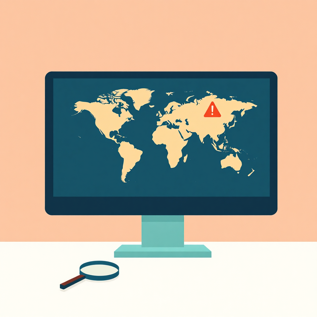
Herman Poppleberry here, and while the view outside is stunning, I have spent most of my day looking at a different kind of map. I have been diving deep into the data that tells us what is happening on the high seas. If you think the world is complicated on land, you should see the digital shadows being cast across the oceans right now.
It is a beautiful evening, and we have got a topic that feels particularly relevant given where we are in the world. Today’s prompt comes from Daniel, and it is a deep dive into the world of maritime tracking. Daniel writes: "Herman and Corn, in the world of open-source intelligence, aviation trackers are highly visible, providing useful data on aircraft movements even when military operations try to go dark. Less visible is maritime traffic tracking. What is the maritime equivalent of A-D-S-B—a positioning feed that ships are required to use? How does the utility of maritime tracking compare to aviation tracking, and how can these two data sources be combined to provide a more comprehensive intelligence picture?"
That is a fantastic prompt, Daniel. It hits on something I’ve been obsessed with lately. While everyone loves tracking planes—and we’ve certainly spent our fair share of time looking at FlightRadar-twenty-four—the ocean is where the real mystery often lies. If aviation tracking is like watching a fast-paced, high-stakes thriller where everything happens in real-time, maritime tracking is more like a slow-burn noir. Everything moves slower, the stakes are massive, the vessels are the size of skyscrapers, and the ways people try to hide are much more creative and, frankly, much more technically interesting.
Right, and Daniel mentioned the Gerald R. Ford aircraft carrier specifically in his expanded notes. It has been a constant topic of conversation here in the Eastern Mediterranean for the last couple of years. Even now, in early twenty-twenty-six, with the regional tensions still simmering, people are constantly trying to figure out exactly where it is. Is it near Crete? Is it sitting just off the coast of Israel? Is it transiting back toward the Atlantic? It highlights this fascinating tension between military secrecy and the public’s ability to track these massive assets using nothing but a laptop and some clever algorithms.
Exactly. And to answer Daniel’s first question directly, the maritime equivalent of A-D-S-B is called A-I-S, which stands for the Automatic Identification System. Just like A-D-S-B for planes, A-I-S was originally designed as a safety tool, not a surveillance tool. It was born out of the need to prevent collisions at sea. If you are a captain of a massive container ship in a thick fog in the English Channel, you want to know exactly where every other ship is, how fast they are going, and what their heading is. A-I-S allows ships to automatically broadcast that data to other ships and coastal stations.
So, it is basically a "don't hit me" beacon?
Precisely. Before A-I-S, you were relying mostly on radar and radio communication. But radar has limitations. It can be affected by heavy weather, it can be blocked by large obstacles, and it doesn't tell you the "identity" of the ship—just that there is a hunk of metal over there. A-I-S provides a much clearer picture. It uses V-H-F, or Very High Frequency radio waves, to transmit data packets. These packets are sent using a system called Self-Organized Time Division Multiple Access. That is a mouthful, but it basically means the ships talk to each other to decide who broadcasts when, so they don't all talk over each other on the same frequency.
Okay, let's get into the technical weeds for a second, because I know you want to. What is actually in those data packets? Is it just a name and a location?
It is actually quite a bit of information. There are three main types of data. First, you have static information, which is programmed into the unit and rarely changes. This includes the ship's name, its call sign, its length and beam, and its Maritime Mobile Service Identity number, or M-M-S-I. The M-M-S-I is like a digital fingerprint for the ship. Then you have dynamic information, which is updated automatically by the ship's sensors. This is the G-P-S position, the speed over ground, the course over ground, and the rate of turn. Finally, you have voyage-related information, which the crew enters manually. This includes the ship's draft—how deep it is sitting in the water—its destination, and its estimated time of arrival.
So, if the technology is so similar to what planes use, why does it feel like maritime tracking is less visible to the average person? When a high-profile plane takes off, you see screenshots from A-D-S-B Exchange all over social media within minutes. You don't see that as much with ships unless there is a massive crisis, like when the Ever Given got stuck in the Suez Canal back in twenty-twenty-one.
That is a really astute observation, Corn. I think there are a few reasons for that. First, there is the simple factor of speed. A plane crosses a continent in a few hours. A ship crosses an ocean in two or three weeks. The "drama" of a ship's movement is stretched out over a much longer period, so it doesn't trigger that same "breaking news" reflex in our brains. But more importantly, the technical infrastructure for maritime tracking is actually a lot more challenging than it is for aviation.
How so? I would think tracking something on a flat ocean would be easier than tracking something in three-dimensional airspace where altitude and terrain come into play.
You would think so, but remember those V-H-F radio waves I mentioned? They are line-of-sight. On land, you can set up a cheap A-D-S-B receiver in your backyard and track planes for two hundred or even three hundred miles because they are thirty thousand feet in the air. There is nothing between your antenna and the plane. But ships are at sea level. Because of the curvature of the earth, a coastal A-I-S station can usually only "see" ships out to about twenty or perhaps forty nautical miles. If the antenna is really high up on a cliff, maybe you get sixty miles. But that’s it.
So once a ship hits the high seas and moves away from the coast, it essentially disappears from the coastal receivers?
Exactly. For a long time, the middle of the ocean was a total black hole for A-I-S tracking. To solve this, we had to start putting A-I-S receivers on satellites. This is called S-A-I-S, or Satellite A-I-S. But this introduces a whole new set of problems. Satellites are hundreds of miles up, and they are trying to pick up relatively weak radio signals from thousands of ships all at once. Imagine being in a giant stadium where everyone is whispering, and you are trying to hear one specific person from the top row of the bleachers. It creates a massive signal processing challenge. The data is often delayed, it can be expensive to access, and it is not as "real-time" as the aviation data we are used to. Companies like Spire and Orbcomm have made huge strides here, but it’s still a much "noisier" environment than aviation.
That makes sense. It is a technical hurdle that the average hobbyist can't easily overcome without paying for a premium subscription. But let's talk about the "going dark" aspect that Daniel mentioned. We know that military planes often turn off their A-D-S-B transponders when they are on a mission or entering sensitive airspace. Is it the same for ships? Does a carrier like the Gerald R. Ford just flip a switch and vanish from the map?
It can, but the legal and strategic framework is different. Under International Maritime Organization regulations—specifically the S-O-L-A-S convention, which stands for Safety of Life at Sea—most large ships are required to keep their A-I-S on at all times. This includes all ships of three hundred gross tonnage or more on international voyages, and all passenger ships regardless of size. However, there is a "master's discretion" clause. If a captain believes that keeping the A-I-S on poses an immediate safety or security risk to the ship—like in pirate-infested waters or a conflict zone—they can turn it off.
And I imagine a thirteen-billion-dollar aircraft carrier in a conflict zone like the Eastern Mediterranean definitely qualifies as a security risk.
You would think so, but here is the catch. Sometimes, a military ship wants to be seen. It is called "strategic signaling." By leaving their A-I-S on, they are essentially saying, "We are here, we are powerful, and we are watching." It is a way of projecting presence and deterrence without firing a shot. The Gerald R. Ford might leave its A-I-S on while it is transiting the Mediterranean just to remind everyone of its location and its capabilities. It is a digital show of force. But the moment they want to conduct a sensitive operation, or if they feel they are being targeted, that switch goes off instantly.
So, when they go dark, how do the O-S-I-N-T people—the open-source intelligence community—keep track of them? If the A-I-S is off, are they just gone into the void?
Not at all. That is where the real detective work begins, and this is where maritime tracking becomes much more multi-dimensional than aviation tracking. This is where you start combining A-I-S with other data sources. The most powerful one today is satellite imagery. We have constellations of satellites now from companies like Planet and Maxar that can take high-resolution photos of almost anywhere on earth every single day. If you know the general area where a carrier was last seen, you can scan the latest satellite passes for a wake or a hull shape that matches.
But wait, the ocean is huge. The Mediterranean alone is nearly a million square miles. You can't just have people manually scanning thousands of square miles of blue water looking for one ship, can you?
Well, you can't do it manually, but you can use S-A-R, which stands for Synthetic Aperture Radar. S-A-R satellites are the absolute game-changer in maritime O-S-I-N-T. Unlike optical satellites, S-A-R satellites don't need the sun. They can see through clouds, they can see through smoke, and they work perfectly at night. They send out radar pulses and measure what bounces back. Metal ships reflect radar waves incredibly well, so they show up as bright, glowing white dots against the dark, non-reflective background of the water. You can run an automated algorithm over a S-A-R image of the entire Eastern Mediterranean and find every single large metallic object in a matter of minutes.
Okay, that is fascinating. So the workflow is: you find a bright dot with the S-A-R radar, and then you cross-reference it against the A-I-S data. If there is a bright dot on the radar but no corresponding A-I-S signal at those coordinates, you have found a "dark" ship.
Exactly. That is the "aha" moment for maritime investigators. If you have a hundred ships in a specific sector and ninety-nine of them are broadcasting A-I-S, that one silent ship is suddenly the most interesting thing on the map. It might be a warship like the Ford, it might be a "shadow fleet" oil tanker trying to bypass sanctions, or it might be a vessel engaged in illegal, unreported, and unregulated fishing. By combining the "truth" of the radar with the "claims" of the A-I-S, you can spot the liars.
This brings me back to Daniel’s question about combining these sources. How do aviation and maritime data play together to give a bigger picture? I am thinking about the logistics of a carrier strike group. A carrier doesn't just sit there in isolation; it is the center of a massive web of activity. It needs constant supplies. It needs fuel, it needs food, and it needs specialized parts for its aircraft.
You hit the nail on the head. Logistics is the thread that connects the sky and the sea. If you are watching a carrier like the Ford, you don't just watch the ship. You watch the "delivery drivers." Specifically, you watch the C-two Greyhound transport planes or the newer C-M-V-twenty-two-B Ospreys that fly from land bases out to the carrier. These planes often leave their A-D-S-B on for safety reasons while they are transiting busy civilian flight paths or climbing to altitude. If you see a C-two Greyhound take off from a naval air station in Sicily or Greece, and then you see it disappear from the radar at a certain set of coordinates in the middle of the Ionian Sea, there is a very high probability that the carrier is sitting right underneath that "disappearance" point.
That is brilliant. It is like following the Amazon delivery truck to find the location of the secret warehouse.
Precisely. And it goes even deeper. You can look at port activity. If you see a sudden surge of heavy transport aircraft like C-seventeen Globemasters landing at a naval air station in Cyprus, and then a few days later you see a group of T-A-K-E class supply ships—those are the big Lewis and Clark-class dry cargo ships—departing from a nearby harbor, you can start to piece together a major resupply operation. The aviation data gives you the "what" and the "when," and the maritime data gives you the "where" and the "how much." When you overlay these two datasets, the "dark" spots in the maritime record start to get filled in by the "bright" spots in the aviation record.
It sounds like maritime tracking requires a lot more patience than aviation tracking. With planes, you get that instant gratification of seeing the flight path curve across your screen. With ships, you are looking for subtle patterns over days and weeks.
It definitely does. It’s a game of endurance. There is also the issue of "spoofing," which is much more common and much more sophisticated in the maritime world than in aviation. Because A-I-S is an unencrypted, unauthenticated radio signal, it is actually quite easy to fake. A ship can broadcast that it is in the middle of the South Atlantic when it is actually sitting in a port in the Persian Gulf.
Wait, really? How do they get away with that? Don't the satellites see them and call their bluff?
They do, and that is how they get caught, but it’s a constant cat-and-mouse game. There was a famous case a few years ago where a group of tankers was caught "circle dancing." Their A-I-S signals showed them moving in perfect, synchronized circles in the middle of the ocean—a physical impossibility for ships of that size. When investigators checked the satellite imagery, there were no ships there at all. They were using a sophisticated G-P-S spoofing device to broadcast fake coordinates to the A-I-S system to hide the fact that they were actually at a terminal loading oil in a sanctioned country.
That is wild. It is like a digital smoke screen. It makes me realize that A-I-S data on its own isn't just "less visible," it is also potentially "less reliable" if you don't have other ways to verify it.
Exactly. In the O-S-I-N-T world, we have a saying: "One source is no source." You always need to triangulate. If a ship's A-I-S says it is in the Atlantic, but a S-A-R satellite shows a ship-shaped object in the Persian Gulf, and a social media post from a sailor shows a specific sunset that only happens in the tropics... well, you start to see the truth. We are even seeing G-N-S-S interference—that’s Global Navigation Satellite System interference—right here in the Eastern Mediterranean. Ships and planes are both reporting that their G-P-S is showing them at the Beirut airport when they are actually miles away at sea. This "electronic warfare" environment makes tracking even more of a puzzle.
I love that. It turns the whole world into a giant, high-stakes puzzle. Let's talk about the platforms people can use to see this for themselves. Daniel mentioned A-D-S-B Exchange and FlightRadar-twenty-four for planes. What are the equivalents for ships? Where can a beginner go to start looking at this?
The big ones are MarineTraffic and VesselFinder. They are very user-friendly and have great maps. They rely on a global network of land-based receivers, many of which are hosted by volunteers, just like the aviation trackers. If you live near a coast, you can actually buy a cheap A-I-S receiver for about a hundred dollars, plug it into your internet, and feed data to these sites. In exchange, they usually give you a free premium subscription.
Are there "unfiltered" versions like A-D-S-B Exchange? I know one of the reasons people love A-D-S-B Exchange is that they don't filter out military or private jets that ask to be hidden from the commercial sites.
That is a bit tougher in the maritime world. Most of the big commercial sites do some level of filtering for "security reasons," or they have "premium" tiers where the really interesting data, like the satellite A-I-S, is hidden behind a very expensive paywall—we’re talking thousands of dollars a year. However, there are projects like Global Fishing Watch that are trying to bring more transparency to the oceans. They use machine learning to analyze A-I-S patterns and identify suspicious behavior, and they make a lot of that data available for free to researchers and the public. There is also SkyFi, which allows you to "order" a satellite photo of a specific coordinate for a relatively low price, which is a huge step forward for amateur investigators.
It feels like the "democratization" of maritime intelligence is a few years behind aviation, but it is catching up fast.
It is. And as the cost of launching small satellites—CubeSats—continues to drop, we are going to see more and more "eyes in the sky" that can verify what is happening on the water. We are moving toward a world where it will be almost impossible for a large ship to truly "go dark" for any significant amount of time. The sheer volume of data being generated by S-A-R, optical imagery, and radio frequency monitoring is becoming overwhelming for those who want to hide.
That has huge implications for everything from global trade to naval warfare. If you can't hide, you have to change your entire strategy.
Absolutely. It changes the nature of deterrence. If everyone knows exactly where your aircraft carrier is at all times, the "surprise" element of your power is diminished. But at the same time, it can also prevent misunderstandings. If everyone can see that a ship is just a civilian freighter and not a disguised warship, it might prevent an accidental escalation in a tense area like the Red Sea or the South China Sea.
That is a very "Herman" way of looking at it, finding the silver lining in the end of privacy. You always look for the stabilizing factor in the data.
Guilty as charged. I just find the transparency fascinating. Think about the "dark fleets" or "shadow fleets" that move oil around the world to bypass sanctions. These are often older ships, with questionable insurance and registrations, that turn off their A-I-S to hide their movements. They are a massive environmental risk because if they have a collision or a spill, nobody knows who is responsible. If we can use these combined data sources to track them, we can hold the owners accountable before a disaster happens. We can see them "ship-to-ship" transferring oil in the middle of the night using S-A-R imagery.
That is a great point. It is not just about military intelligence; it is about environmental and economic security. I am curious, Herman, if you were a beginner who wanted to start tracking the maritime side of things today, what would be your first move?
I would start by picking a specific "choke point." Places like the Strait of Gibraltar, the English Channel, the Suez Canal, or the Bosphorus. These are areas where ships are forced to congregate and move in predictable lanes. Open up MarineTraffic or VesselFinder and just watch the flow for a few days. You will start to notice the different types of ships—the massive container vessels that are four hundred meters long, the tankers, the tugboats. Then, try to find a ship that looks out of place. Maybe it is a ship with no destination listed, or one that has a weird name, or one that is loitering in a strange area.
And once you find a "weird" ship, what then? What is the next step in the investigation?
Then you start digging. Look up its I-M-O number. That is a seven-digit unique identifier that stays with the ship for its entire life, from the day it is launched to the day it is scrapped, even if it changes its name or its flag ten times. You can find out who the "beneficial owner" is, what its history is, and where it has been. Then, check social media. Sailors are human, and they love to post photos on Instagram, TikTok, or Facebook. Sometimes you can find a photo of a specific ship taken by a crew member just a few hours ago that confirms its location or shows exactly what it is carrying on deck.
It is like being a digital private investigator, but your "office" is the entire world's oceans.
Exactly. And if you really want to get serious, you start looking at the weather. Ships are at the mercy of the sea in a way that planes usually aren't. If you see a ship's speed drop suddenly from twenty knots to five knots, check the wave height and wind speed in that area using a site like Windy-dot-com. It adds another layer of reality to the data on your screen. You realize these aren't just dots on a map; they are real people in a very challenging, often dangerous environment.
That is a good reminder. It is easy to get caught up in the "intelligence" aspect and the technical data and forget the human element. Speaking of real people, we should probably mention that if you are finding this kind of deep dive interesting, we would really appreciate it if you could leave us a review on your podcast app. Whether you are on Spotify or Apple Podcasts, those ratings really help other people find the show and join our little community of prompt-seekers.
They really do. We love seeing the community grow, and your feedback helps us know which of Daniel’s prompts are hitting the mark. We’ve been doing this for a while now, and it’s the listeners who keep the lights on and the data flowing.
So, to bring it back to Daniel’s original question—maritime tracking is the "slow and steady" counterpart to aviation tracking. A-I-S is the primary tool, but the real power comes from the synthesis. It’s about combining that radio feed with satellite imagery, radar intercepts, and even aviation data to build a three-dimensional picture of global movement.
Right. And as we see more high-value assets like the Gerald R. Ford moving through our waters here in the Mediterranean, the ability to piece together that comprehensive intelligence picture becomes more than just a hobby for nerds like me. It becomes a vital way for the public to understand what is happening in the world, independent of what official government spokespeople might be saying.
It is about accountability, in a way. The more we can see, the harder it is for things to happen in the shadows. It’s about bringing light to the "dark" parts of the map.
Exactly. The ocean is no longer the vast, unknowable void it once was. It is a data-rich environment, and we are just starting to learn how to read the language of the waves and the wires.
Well, I think we have covered a lot of ground—or water—today. We have talked about the technical hurdles of V-H-F versus satellite A-I-S, the art of "going dark" and "strategic signaling," and the power of logistics as a tracking tool.
It is a fascinating field that is only going to get more complex as we move further into twenty-twenty-six and beyond. I am already looking forward to the next time a "ghost ship" appears on the radar and the O-S-I-N-T community springs into action to solve the mystery.
I am sure it won't be long. Before we go, I want to remind everyone that you can find all our past episodes and a way to get in touch with us at our website, myweirdprompts-dot-com. We have an R-S-S feed there for subscribers and a contact form if you want to send us your own thoughts or a prompt of your own.
And you can always reach us at show at myweirdprompts-dot-com. We love hearing from you, even if it is just to tell me I am being too nerdy about radio frequencies or the Doppler effect in S-A-R imagery.
Which happens more often than you would think, Herman. But that’s why people tune in.
Hey, someone has to care about the megahertz! If we don't care about the frequencies, who will?
Fair enough. Well, this has been My Weird Prompts. Thanks for listening, and we will catch you in the next one.
Goodbye, everyone. Stay curious, and keep digging into the data.
And keep an eye on those horizons. Goodbye!

")