Daniel sent us this one — he's pointing out that most people think of Canada as Vancouver, Toronto, the strip along the US border. But open a map and Canada just keeps going, all the way up to the North Pole. How much of that territory is basically empty? How far north in Nunavut do people actually live? And how does a modern state even function when its territory includes places where the nearest neighbor is hundreds of kilometers away? He also wants us to talk about Alert, which is its own kind of extreme. There's a lot here.

Let's start with a number that will rewire how you see Canada: ninety-four percent.
Ninety-four percent what?
Ninety-four percent of Canadian territory has zero permanent residents. That's the government's own data — Census Metropolitan Areas versus Census Subdivisions. The inhabited zone, what geographers call the ecumene, is roughly three hundred thousand square kilometers. Canada's total landmass is nine point nine eight million square kilometers. So the remaining ninety-seven percent has a population density below zero point one people per square kilometer. For comparison, Mongolia is about two people per square kilometer. Most of Canada makes Mongolia look like downtown Tokyo.
Mongolia is not the flex you think it is, given my background.
Your background is a topic for another day. The point is, Canada is the second-largest country on Earth by land area, and almost all of it is empty. Not rural — empty. There's a difference between farmland with a few houses per mile and territory where you can fly for hours and see no human structure at all.
The ninety percent stat people throw around — ninety percent of Canadians live within a hundred sixty kilometers of the US border — that's the other side of the same coin. You've got this thin ribbon of population along the southern edge, and then everything north of that is a different country in all but name.
And to be precise, Canada is divided into ten provinces and three territories. The provinces are in the south — British Columbia, Alberta, Saskatchewan, Manitoba, Ontario, Quebec, and the Atlantic provinces. The three territories are Yukon, Northwest Territories, and Nunavut. Together they cover about forty percent of Canada's landmass but contain about zero point three percent of the population.
Nunavut alone is the size of Mexico.
Nunavut is two million ninety-three thousand square kilometers. Mexico is one point nine six million. Nunavut is larger. Population of Mexico: about a hundred twenty-nine million. Population of Nunavut: about forty thousand. Eighty-five percent Inuit. You could fit every single resident of Nunavut into a mid-sized football stadium.
The question becomes: what does inhabited even mean when your territory goes all the way to the North Pole? And how does Canada classify what's remote versus what's extremely remote?
The government uses a few different frameworks. Statistics Canada has something called the Remoteness Index, which measures each community's distance from population centers and service hubs. But honestly, the lived reality is simpler: there are communities connected by road, and then there's everything else. Twenty-five of Nunavut's twenty-six communities have no road connection to the rest of Canada. The only exception is a seasonal ice road connection for a mining operation.
The entire territory is fly-in only.
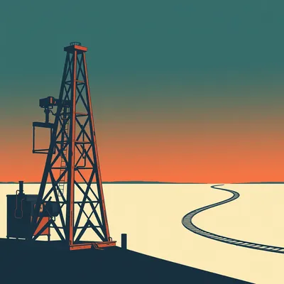
Fly-in only. Every person, every piece of lumber, every bag of flour, every snowmobile, every hospital bed — it all arrives by air or by annual sealift. The sealift is a convoy of barges that comes once a year during the brief summer window when the ice clears. Communities place their orders months in advance. If you forget to order something, you wait a year or you pay air freight at two to five dollars per kilogram.
Your Amazon Prime delivery window is basically "next July, maybe.
That's not far off. And this isn't a handful of tiny outposts. Iqaluit, the capital of Nunavut, has about seventy-eight hundred people. That's the largest community in the territory. It has a hospital, a legislative assembly, schools, a university campus — and no road connecting it to anywhere else. If you want to drive from Iqaluit to Ottawa, you can't. The road doesn't exist.
To understand how Canada manages this emptiness, we need to first understand just how empty it really is — and where the few people who live north of sixty actually are.
Let me give you the north-south map in your head. The sixtieth parallel is the boundary between the provinces and the territories for most of western Canada. Cross that line heading north and you're in the territories. But even within the territories, the population clusters near the southern edge. Yellowknife, the capital of Northwest Territories, is at sixty-two degrees north — about twenty thousand people, connected by road to Alberta. Whitehorse in Yukon has about twenty-eight thousand, also road-connected.
Nunavut is where it gets extreme.
Nunavut is almost entirely above the Arctic Circle. The territory was created in nineteen ninety-nine, carved out of the eastern portion of the Northwest Territories as part of the largest indigenous land claim settlement in Canadian history. It's an Inuit-governed territory — the name literally means "our land" in Inuktitut. And the communities are scattered across an area the size of Western Europe.
How far north do people actually live year-round?
The northernmost civilian community in Canada is Grise Fiord. It sits at seventy-six degrees twenty-five minutes north, on the southern tip of Ellesmere Island. Population: about a hundred thirty as of the twenty twenty-one census. It's eight hundred kilometers north of the Arctic Circle. The sun sets in late October and doesn't rise again until mid-February. The average February temperature is around minus thirty-five Celsius, and that's before wind chill.
Grise Fiord has a particular history that's worth understanding, because it wasn't a natural settlement.
No, it wasn't. Grise Fiord was founded in nineteen fifty-three as part of a forced relocation of Inuit families by the Canadian government. The official line was that these families were being moved to better hunting grounds, but the real reason was sovereignty. Canada needed human presence in the High Arctic to assert its territorial claims during the Cold War. Eight families from northern Quebec were relocated to Grise Fiord and another community, Resolute. They were promised they could return after a year if they wanted. They were not told that the ship that brought them would not be coming back.
They were human flags.
That's the uncomfortable term, but yes. The government used Inuit families as sovereignty markers. The relocation was devastating — the families were dropped in a place they'd never seen, with a climate far harsher than what they knew, different wildlife migration patterns, and no way to leave. The Canadian government formally apologized in two thousand ten and established a ten million dollar trust fund for the survivors and descendants. But Grise Fiord remains. It's still there, still occupied, still only accessible by air or annual sea barge.
It's not even the northernmost settlement in Canada. That title belongs to Alert.
We'll get to Alert. But first, let me paint the full picture of how these communities function day to day. Because Grise Fiord isn't unique in its isolation — it's just the most extreme example of a pattern that repeats across Nunavut.
We've established that most of Canada is empty. But empty doesn't mean ungoverned. The question is: how do you run a country when your territory includes places where the nearest police officer is a three-hour flight away?
Let's start with governance itself. Nunavut uses a consensus government model — there are no political parties at the territorial level. Members of the Legislative Assembly are elected as independents, and they choose the premier and cabinet from among themselves by secret ballot. It's a system rooted in Inuit traditions of collective decision-making rather than adversarial debate.
Which sounds civilized until you realize it's also a practical necessity — when your entire territory has forty thousand people, party politics would just mean everyone knows everyone's business anyway.
Each hamlet has a mayor and council, but many administrative functions are centralized in Iqaluit or even in Ottawa. The territory's budget is about four billion dollars annually. For forty thousand people, that's roughly a hundred thousand dollars per resident. Per capita spending in southern provinces like Ontario or British Columbia runs around thirty to thirty-five thousand. So Nunavut costs roughly three times as much to govern per person.
What do you get for a hundred thousand dollars per resident?
Let's walk through the basic functions of a state. Nunavut has one hospital, in Iqaluit. There are health centers in larger communities staffed by nurses and community health workers, but for anything beyond basic care, you fly. The medical travel system is the backbone of northern healthcare — patients are flown to Iqaluit, Yellowknife, or southern cities like Ottawa and Edmonton for specialist appointments, diagnostics, and emergency care. In twenty twenty-three to twenty twenty-four, Nunavut spent forty-five million dollars on medical travel alone.
Forty-five million dollars, for forty thousand people. That's over eleven hundred dollars per resident per year just on transportation to healthcare, before you even pay for the healthcare itself.
That's before you consider the human cost. A routine specialist appointment that takes a morning in Toronto might mean a three-day trip for someone from Cambridge Bay or Pond Inlet — flights both ways, accommodation, time away from family and work. If the weather turns, you're stuck. Medical travel delays are a constant reality.
What about education?
High schools only exist in the larger hamlets. Students from tiny communities have to board in regional centers. Kids from Grise Fiord attend high school in Iqaluit — that's eleven hundred kilometers south. At fourteen years old, you leave your family and move to a boarding home in a city you might have visited twice in your life.
That's a lot to ask of a teenager.
And the infrastructure in the communities themselves is constrained by cost and logistics. Most communities rely on satellite internet with speeds of five to fifteen megabits per second. That's functional for basic web browsing and email, but it makes telehealth, distance learning, and remote work extremely challenging. There's been investment in fiber and low-earth-orbit satellite services like Starlink, but deployment is slow and expensive.
Now let's talk about policing and justice, because this is where the state's thin presence gets really tangible.
The RCMP — the Royal Canadian Mounted Police — operates what's called the detachment system across the north. But "detachment" is a generous term. In many communities, there is no permanent police presence. One officer may cover multiple communities, flying in for a few days each month. If something happens when the officer isn't there, you wait.
What happens when someone commits a crime in a community with no police station?
The RCMP responds from the nearest detachment, which might be hundreds of kilometers away. Investigations can take days to even begin. And the court system operates on the same model — it's called the circuit court. A judge, a prosecutor, and a defense lawyer fly into a community on a rotating schedule, sometimes only a few times a year. They set up court in a community hall or school gymnasium, hear all pending cases over a few days, and move on. If you're arrested between circuits, you might wait months for a hearing.
Justice is seasonal.
It's a good way to put it. And this creates real tensions. The system is slow, it's culturally disconnected — most judges and lawyers fly in from the south, don't speak Inuktitut, and don't understand community dynamics. There have been efforts to incorporate Inuit Qaujimajatuqangit, traditional Inuit knowledge and legal principles, into the justice system, but it's been slow going.
Then there's the military dimension. Canada has to project sovereignty into places where it can barely maintain a road.
Operation NANOOK is the Canadian Armed Forces' annual Arctic sovereignty exercise. It's been running since two thousand seven, and it involves deploying ships, aircraft, and personnel into the Arctic for training and presence patrols. But the more interesting piece is the Canadian Rangers.
The Rangers are the part-time reservists, right?
Yes, but they're unlike any other military unit. The Canadian Rangers are a reserve sub-component made up primarily of indigenous northerners who serve as the military's eyes and ears in remote communities. There are about five thousand Rangers across more than two hundred communities. They use their own equipment — snowmobiles, boats, all-terrain vehicles — and they're trained in traditional survival skills alongside basic military skills. Their primary job is sovereignty patrols: they travel across the land, report unusual activity, and maintain a visible Canadian presence.
They're the human layer of NORAD's northern sensor grid.
NORAD — the North American Aerospace Defense Command — has been modernizing its northern radar network, but radar can only tell you something is there. The Rangers can tell you what it is, who's operating it, and whether it's a threat. They're also the first responders in many communities for search and rescue, natural disasters, and even pandemic response. During COVID, Rangers helped distribute supplies and enforce quarantine in fly-in communities.
Now we get to Alert, which is the logical endpoint of all of this. Everything we've been talking about — sovereignty, isolation, the cost of presence, the state reaching into emptiness — Alert is where it all converges.
Canadian Forces Station Alert is the northernmost permanently inhabited settlement in the world. It sits at eighty-two degrees twenty-eight minutes north, on the northeastern tip of Ellesmere Island. It's eight hundred seventeen kilometers from the North Pole. That's closer to the pole than to Iqaluit. The average annual temperature is minus eighteen Celsius, and the sun doesn't rise above the horizon from mid-October to late February. In summer, it doesn't set for four months.
Unlike Grise Fiord, nobody was relocated there. Nobody is from there. This is a pure state outpost.
Alert was established in nineteen fifty as a joint Canada-United States weather station. That was the public story. By the nineteen sixties, its primary function had shifted to signals intelligence. Alert is part of the Five Eyes network — the intelligence-sharing alliance between the US, UK, Canada, Australia, and New Zealand. Its location, just over eight hundred kilometers from the North Pole and a few thousand kilometers from Russia's northern coast, makes it ideally positioned to intercept Russian military communications, submarine transmissions, and satellite telemetry.
The official line is still "weather station.
The official line is a weather station that also does some "environmental monitoring." The actual mission is electronic surveillance. The station houses the Alert Global Atmosphere Watch Observatory, which does legitimate climate and atmospheric research — that part is real. But the main facility is a signals intelligence operation run by the Communications Security Establishment, Canada's equivalent of the NSA.
How many people are actually there?
The population fluctuates between about fifty-five and a hundred. Everyone is military or civilian personnel on rotation. No families, no children, no permanent residents. Tours are typically six months. The station is resupplied by CC-one-thirty Hercules flights from either Thule Air Base in Greenland or CFB Trenton in Ontario. The airstrip is gravel, fifty-five hundred feet long, and only operational about six months of the year. During the dark months, when the gravel runway is frozen solid and unusable, resupply is extremely limited.
There's an annual sealift too?
Yes, during the brief summer window. But the sea ice at that latitude is unpredictable even in August. In twenty twenty-two, the station suffered a major fire that destroyed the main building. A hundred million dollars plus in damages, a partial evacuation, and a multi-year rebuild that was only completed in twenty twenty-five. The fire happened in October — the start of the dark season — which made the response exponentially more difficult.
A hundred million dollars to rebuild a station that exists primarily to listen to Russian radio traffic from the top of the world.
That's the core tension. Alert exists because not being there would cede the Arctic. If Canada didn't maintain a presence at eighty-two degrees north, other nations would fill the vacuum. Russia has been aggressively expanding its Arctic military infrastructure — reopening Soviet-era bases, building new airstrips, deploying advanced radar and missile systems along its northern coast. China has been positioning itself as a "near-Arctic state" and investing in Arctic research and infrastructure through its Polar Silk Road initiative.
Alert is a flagpole, essentially. A very expensive, very cold flagpole with listening equipment.
A flagpole that costs somewhere in the range of tens of millions of dollars annually to operate, staffed by people who spend half the year in darkness, doing work that officially doesn't exist, in a place where the nearest tree is over two thousand kilometers south.
What's daily life actually like there?
It's institutional. You live in barracks-style quarters. Meals are in a communal dining hall. There's a gym, a library, a bar — the standard military base amenities, just compressed into a single small compound at the edge of the habitable world. Recreation is indoor by necessity. Internet connectivity exists but is limited and routed through military networks. Outside, the terrain is polar desert — rock, ice, and gravel. The "soil" is permafrost.
You can't just go for a walk.
You can, but the protocol is strict. Polar bear risk is real — Ellesmere Island has a significant bear population. Anyone going outside the station perimeter carries a firearm and checks in and out. In winter, with twenty-four-hour darkness and temperatures that can drop below minus fifty Celsius with wind chill, an unsupervised walk is potentially fatal within minutes.
The mental health dimension of that has to be significant.
Personnel are screened for psychological fitness before deployment, but the strain is real. Six months of darkness, isolation, institutional monotony, and the knowledge that you're eight hundred kilometers from the North Pole and a long flight from any real city — it's not for everyone. The military doesn't publish detailed mental health statistics for Alert specifically, but Arctic postings in general have higher rates of reported stress and adjustment difficulties.
That brings us to the uncomfortable question at the heart of this episode: is maintaining this presence worth the cost?
Let me give you the numbers in one place. Nunavut's territorial budget: about four billion dollars annually for forty thousand people. That's a hundred thousand dollars per resident. Medical travel alone: forty-five million. The rebuild of Alert after the fire: over a hundred million. Operation NANOOK, the Rangers program, the sealift subsidies, the air freight subsidies, the housing subsidies — Canada spends billions every year maintaining a presence across territory where almost nobody lives.
The counterargument is: what's the alternative?
The alternative is vacating the Arctic, which would effectively cede sovereignty over millions of square kilometers of territory, including the Northwest Passage. As Arctic ice melts — and it's melting fast — the Northwest Passage is becoming a viable shipping route. A journey from Shanghai to Rotterdam via the Northwest Passage is about seven thousand kilometers shorter than via the Panama Canal. Whoever controls that route controls one of the most strategically significant chokepoints of the twenty-first century.
Canada passed the Arctic Shipping Safety and Pollution Prevention Regulations in twenty twenty-five to assert control over that route. But enforcement is nearly impossible when you can barely get a coast guard vessel into those waters for most of the year.
Canada claims the Northwest Passage as internal waters. The United States and most other maritime nations consider it an international strait. That's a legal dispute that's been simmering for decades, and as the ice recedes, it's going to come to a head. Canada's position depends entirely on maintaining a credible presence in the Arctic. You can't claim sovereignty over waters you can't patrol.
The cost isn't just about services for forty thousand Nunavummiut. It's about the territorial integrity of the entire country.
That's what makes the Canadian case so unusual. Most countries with vast empty spaces — Australia, Russia, Brazil — have those spaces contiguous with their populated regions. Canada's empty space is at the top, disconnected, separated by climate and geography. It's not "the outback" you can drive into. It's an entirely separate logistical domain.
There's a parallel here with what we've talked about before — the episode on Arctic militarization and ice melt geopolitics. That episode focused on the international competition angle. This is the internal dimension: how Canada actually operates as a state across territory that is, for all practical purposes, uninhabitable.
The internal dimension is where the contradictions get interesting. Canada is simultaneously a G7 industrial power with universal healthcare, a sophisticated financial sector, and world-class cities — and also a country that maintains a nineteenth-century-style frontier presence across most of its landmass, complete with circuit courts, seasonal supply ships, and sovereignty-by-human-presence.
The twenty twenty-six Canadian Arctic Foreign Policy Framework, released in March, commits to building a new Arctic research station and expanding the Rangers program. But it doesn't propose any new permanent settlements. The north will remain mostly empty by design. The policy is explicit about this — Canada's Arctic presence will be maintained through military and scientific outposts, not through colonization.
Which is a deliberate choice. The forced relocation that created Grise Fiord is now recognized as a historical injustice. The modern approach is to support existing Inuit communities where they are, not to move people into the High Arctic as sovereignty markers. But that leaves the question: if you're not going to populate the north, how do you hold it?
The answer, for now, is what we've been describing: a patchwork of military outposts, seasonal logistics, indigenous communities that serve as de facto human flags, and a legal framework that asserts sovereignty even where enforcement is thin. It's expensive, it's fragile, and it depends on the assumption that no other power will directly challenge it.
Climate change is rewriting the assumptions underneath all of this. The Arctic is warming roughly four times faster than the global average. Sea ice extent has declined by about thirteen percent per decade since nineteen seventy-nine. The Northwest Passage had its first fully ice-free summer in — well, it hasn't happened yet, but multiple projections suggest it could occur within the next decade or two. When it does, the strategic calculus changes completely.
The next time you look at a map of Canada, mentally erase everything north of the sixtieth parallel except a few dozen dots. That's the real Canada — a country that is simultaneously a modern industrial democracy and a vast, nearly empty Arctic territory held together by logistics, law, and will.
Alert is the purest expression of that. A tiny cluster of buildings on a gravel plain at the top of the world, staffed by people who spend months in darkness, listening to signals from across the pole, maintaining a presence because absence would mean something very different. Alert is Canada distilled to its essence: a small, expensive, stubborn outpost in a vast and unforgiving environment, maintained because the alternative is unthinkable.
The question that sits underneath all of this — and I don't think there's a clean answer — is whether this model is sustainable as the Arctic becomes more accessible and more contested. Russia's Northern Fleet has been modernizing. China is building icebreakers and research stations. The US and Canada have deepened their Arctic security cooperation, but the asymmetry is stark: Russia has dozens of Arctic bases, Canada has a handful of outposts and a network of part-time Rangers on snowmobiles.
The twenty twenty-six framework commits to more investment, but it's incremental. A new research station, a few more Rangers, upgraded satellite coverage. Nobody is proposing a fundamental rethink of how Canada holds the north. The model is "thin presence, high cost" and that's likely to remain the model for the foreseeable future.
Because the alternative — building roads, ports, and permanent infrastructure across millions of square kilometers of permafrost — would cost hundreds of billions and make the current hundred thousand dollars per resident look like a bargain.
Would raise questions about environmental impact, indigenous rights, and whether anyone would even want to live there. The north isn't empty because of a failure of policy. It's empty because it's one of the least hospitable environments on Earth. The remarkable thing isn't that Canada hasn't populated it — it's that Canada has managed to maintain a functioning state presence there at all.
For the listener who's been following along: Canada's territory stretches to the North Pole, but almost nobody lives north of the tree line. The few who do — about forty thousand people in Nunavut, plus smaller populations in the Northwest Territories and Yukon — live in fly-in communities serviced by annual sealifts, circuit courts, and medical travel systems that cost billions annually. And at the very edge of it all sits Alert, a signals intelligence station that is simultaneously a weather observatory, a sovereignty marker, and a monument to the idea that if you don't occupy something, someone else will.
The cost is enormous. The logic is inescapable. And the future is uncertain. That's Canada above the sixtieth parallel.
Now: Hilbert's daily fun fact.
Hilbert: In the nineteen tens, French mathematician René Maurice Fréchet studied the geometry of a specific tiling pattern found in the mud-brick architecture of Chad's Sara people — a tessellation of irregular pentagons that exactly mirrors the scale arrangement on the pangolin's back, an evolutionary convergence so precise that a mathematician and a zoologist independently described the same geometry within three years of each other, neither aware of the other's work.
I have so many questions, none of which I'm going to ask.
The pangolin's back.
That's our episode. If you enjoyed this, rate us five stars and tell a friend who thinks Canada is just Vancouver and Toronto — they're in for a surprise. This has been My Weird Prompts. I'm Corn.
I'm Herman Poppleberry. Thanks to our producer Hilbert Flumingtop. We'll be back with another one soon.

")