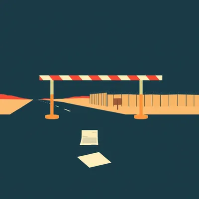
Daniel sent us this one — he's been to every land border in Israel, Metula, Road Ten, the Sinai, and now he's wondering about the maritime ones. If you go swimming in the Dead Sea, you're technically approaching an international border. Eilat and Aqaba are separated by water, not a fence. And up north there's another maritime border with Lebanon. He noticed the buoys only extend a couple hundred meters out, which raises the obvious question — what actually stops someone from renting a kayak and accidentally drifting across? And more broadly, how do navies enforce these invisible lines?

The short answer is radar, radio, and a very deliberate escalation ladder. But the buoys are the thing everyone gets wrong, and that's where we should start.
The buoys aren't the border.
They're not. They're markers for what's called the baseline — the line from which a country measures its territorial sea. Think of it like the starting block in a race, not the finish line. Israel's actual territorial sea extends twelve nautical miles from that baseline, which is about twenty-two kilometers. The buoys you see at Rosh Hanikra or off the Dead Sea are sitting a few hundred meters out, marking where the land effectively ends and the legal measurement begins.
The border is basically a set of GPS coordinates in a patrol boat's navigation system.
And that's not unique to Israel — that's how maritime borders work everywhere under the UN Convention on the Law of the Sea, or UNCLOS. The convention establishes several zones. You've got the territorial sea out to twelve nautical miles, where the coastal state has full sovereignty. Then there's a contiguous zone out to twenty-four nautical miles for customs and immigration enforcement. Then the exclusive economic zone, or EEZ, out to two hundred nautical miles for resource rights — fishing, oil, gas. Each zone has different rules.
Israel signed UNCLOS but never ratified it.
So Israel operates under what's called customary international law — the bits of UNCLOS that are considered binding on everyone regardless of signature. The twelve-nautical-mile territorial sea is customary. The EEZ concept is customary. But some of the dispute resolution mechanisms aren't binding on Israel because they never ratified. It's a weird legal posture, but it works in practice because everyone else mostly follows the same rules.
We've got three maritime borders to talk about. Lebanon in the north, Gaza in the southwest, and Jordan down in the Gulf of Aqaba. Each one operates differently. Let's start with the technology — how does a navy actually know someone's crossing a line that doesn't physically exist?
This is where it gets genuinely impressive. Israel uses a layered sensor network. The backbone is coastal surveillance radar — specifically the EL/M dash two two five eight ALPHA system, deployed along the coast since twenty twenty. It's a phased-array radar that can track small vessels at significant range, even in rough sea conditions. It feeds into a centralized command system that fuses radar data with AIS tracking.
AIS being the Automatic Identification System.
The International Maritime Organization mandated AIS transponders in two thousand two for all vessels over three hundred gross tons. These transponders broadcast the ship's identity, position, course, and speed continuously. So for commercial shipping, the navy has a complete picture. But here's the blind spot — recreational craft, fishing boats under a certain size, kayaks, jet skis — they're exempt from AIS requirements.
Which is exactly the scenario in the prompt. A kayak is invisible to satellite tracking.
So navies fill that gap with radar and visual observation. Israel's nine hundred fourteenth patrol squadron — it's called the Yamam squadron — operates Dabur-class and Super Dvora Mark Three patrol boats specifically for maritime border enforcement. The Super Dvora Mark Three carries the EL slash M two two two one radar system, which is optimized for detecting small, fast-moving targets in cluttered coastal environments. We're talking about a radar that can pick up a fiberglass kayak at several kilometers.
If I'm paddling out of Eilat toward Aqaba, there's a good chance a radar operator somewhere has already seen me before I even realize I'm approaching anything.
And that's where the escalation ladder begins. The first step is almost always a radio hail. International maritime convention says all vessels should monitor VHF channel sixteen — it's the emergency and calling frequency. The patrol boat will hail the vessel on channel sixteen, identify themselves, and instruct the vessel to alter course.
What if you don't have a radio? Which a kayaker probably doesn't.
Then they move to visual and audio signals. Loudspeaker, flashing lights, sirens. If you still don't respond — either because you can't hear them or you're deliberately ignoring them — they escalate to warning shots across the bow. And only after that, if you continue toward the border, do they consider boarding or disabling the vessel.
For Gaza, the policy is shoot-to-disable against engines, not crews.
That policy was formalized after twenty fourteen, during Operation Protective Edge. The Israeli Navy enforces a fishing limit off Gaza that's currently fifteen nautical miles — it was reduced from twenty in two thousand six. Palestinian fishing boats are required to stay within that zone, and the navy monitors it aggressively. If a boat crosses the limit, the standard procedure is to fire warning shots near the vessel. If the boat continues, they target the engine with small-caliber fire. The goal is to stop the boat, not harm the crew.
Which sounds clinical until you remember these are fishing boats — the engine is often right next to where people are standing.
It's an inherently dangerous enforcement mechanism, and there have been casualties. But from the navy's perspective, it's a graduated response designed to avoid the kind of escalation that happened in twenty ten.
The Mavi Marmara.
The Gaza flotilla incident. Six ships attempting to breach the maritime blockade. The Israeli Navy boarded the Mavi Marmara in international waters — about seventy nautical miles from the coast — and the boarding turned violent. Nine activists were killed, ten Israeli soldiers were wounded. It became an international incident. The legal basis for the blockade was contested at the International Criminal Court and the UN Human Rights Council.
That's the extreme end of the spectrum. Most maritime border enforcement is nothing like that. It's routine, it's boring, and it almost never makes the news.
Most of it is fishing boats testing the boundary, getting warned off, and turning around. The navy logs the incident, files a report, and that's it. The drama is in the exceptions.
Let's talk about the Lebanon border, because that one's precarious right now.
The Israel-Lebanon maritime border was unresolved for decades. The core dispute was over a triangular area of about eight hundred sixty square kilometers in the eastern Mediterranean, covering the Qana and Sidon gas fields. Both countries claimed it as part of their EEZ. Hezbollah repeatedly threatened to target Israeli gas platforms if Israel began extraction without a resolution. In June twenty twenty-two — well, the negotiations had been going on for two years — but the breakthrough came in October twenty twenty-two when US envoy Amos Hochstein brokered a deal.
October twenty-seventh, twenty twenty-two.
That's the date. The agreement established what's called a buoy line — Buoy Line One — as the de facto maritime boundary. But here's the catch: it's not a ratified international border. It's a functional demarcation. The agreement allocates the Qana field to Lebanon with a royalty-sharing mechanism for any gas that extends into Israeli waters, and the Karish field remains fully Israeli.
The buoys there are actually closer to being the border than the ones at Rosh Hanikra, but they're still technically a demarcation line, not a ratified boundary.
And Hezbollah has not stopped threatening those platforms. The Karish gas platform is a fixed installation — it can't exactly move if things get kinetic. The Israeli Navy maintains a permanent presence around it, and the coastal radar systems are configured to detect any approaching vessel, including small unmanned surface vessels.
Which brings us to the Jordan border, which is almost weirdly functional by comparison.
The Gulf of Aqaba is a fascinating case. Under the nineteen ninety-four Israel-Jordan peace treaty, the two countries established a special Maritime Boundary Commission that meets quarterly. They coordinate patrols. There's a joint regime area where both countries have agreed-upon enforcement protocols. If an Israeli kayaker drifts toward Aqaba, the Jordanian Coast Guard will likely intercept them within about five hundred meters of the border. They'll ask for ID, check vessel registration if there is one, and escort the person back.
Not unless there's smuggling, a criminal record, or deliberate refusal to comply. Accidental crossings are almost never prosecuted. The Jordanians and Israelis have been doing this for nearly three decades — they've worked out the choreography.
The practical answer to the kayak question is: you'll probably get a loudspeaker warning, possibly a coast guard escort, and a very awkward conversation. Not a prison cell.
Unless you're in Gaza waters, where the enforcement is much more aggressive. Or Lebanon waters near the gas fields, where the stakes are different entirely. The border's character changes depending on the geopolitical temperature.
Let's dig into the baseline concept a bit more, because this is where the legal framework gets clever.
The normal baseline is the low-water line along the coast — basically where the water meets the land at low tide. But coastlines aren't straight lines. They're jagged, they have bays, they have offshore islands. So international law allows for something called straight baselines, where a country with a deeply indented coastline can draw straight lines between appropriate points and measure from there.
This was established by a fisheries dispute between Britain and Norway.
The nineteen fifty-one Anglo-Norwegian Fisheries Case at the International Court of Justice. Norway had drawn straight baselines along its fjord-indented coast, and Britain challenged it because British fishermen were being excluded from waters they'd traditionally fished. The ICJ ruled in Norway's favor, establishing that straight baselines are permissible if the coastline is sufficiently irregular. That precedent is now codified in UNCLOS.
Israel uses straight baselines because of its jagged Mediterranean coast.
The Territorial Waters Law of nineteen fifty-six established Israel's territorial sea at twelve nautical miles from straight baselines drawn along the coast. Those baselines are what the buoys mark — the starting points for measurement.
When someone sees buoys a few hundred meters offshore at Rosh Hanikra and thinks "that's the border," they're off by about twenty-two kilometers.
They're off by an order of magnitude. The border is an invisible line far out at sea. What the buoys are saying is "this is where the legal measurement begins." Beyond that, the enforcement is entirely electronic and physical — radar, patrol boats, and the occasional warning shot.
Let's talk about innocent passage, because this is the other big misconception.
Innocent passage is the right of foreign vessels to pass through a coastal state's territorial sea, as long as the passage is continuous, expeditious, and not prejudicial to the peace, good order, or security of the coastal state. It's a cornerstone of maritime law — without it, international shipping would be impossible.
Just crossing the border isn't automatically a violation.
It's not. If you're a kayaker who accidentally drifts into Jordanian territorial waters, you haven't committed a crime by virtue of crossing an invisible line. What triggers enforcement is what you do while you're there. UNCLOS Article nineteen lists prohibited activities: fishing, surveying, spying, launching aircraft, willful and serious pollution, any act aimed at collecting information to the prejudice of the coastal state's defense or security.
The kayaker is fine. The kayaker with a GoPro who starts filming military installations is not fine.
And that's where the judgment call comes in. The patrol boat commander has to assess intent. Is this a lost tourist or someone probing the defenses? The escalation ladder gives them time to figure that out.
Which connects to something the prompt hinted at — the Dead Sea as a border zone. Most people don't think of it that way.
The Dead Sea is unique in several ways. It's the lowest point on Earth — the surface is about four hundred thirty meters below sea level, and it's three hundred four meters deep at its deepest point. It's not actually a sea — it's a salt lake. And it's bordered by Israel, Jordan, and the West Bank. The maritime border between Israel and Jordan runs roughly down the middle.
There are no patrol boats on the Dead Sea.
There aren't, and that's partly because the Dead Sea is militarily irrelevant — there's no shipping, no strategic depth, no gas fields. It's also shrinking at an alarming rate — about a meter per year — which means the shoreline is constantly shifting. Any fixed maritime boundary would need to be recalculated regularly. In practice, the border is enforced on land at the access points. You can't get a boat onto the Dead Sea without going through a checkpoint.
The border is enforced before you even touch the water.
Which is a different model entirely from the Mediterranean or the Gulf of Aqaba. It's access control rather than maritime patrol.
Let's talk about the Gaza fishing limit in more detail, because it's one of the most actively enforced maritime boundaries on the planet and most people don't understand the mechanics.
The limit has changed multiple times. During the Second Intifada, it was reduced to six nautical miles. After Operation Protective Edge in twenty fourteen, it was set at six, then expanded to nine, then fifteen during calmer periods. It's been adjusted as a political tool — expanded when there's relative calm, contracted when there's rocket fire or border violence.
The enforcement is constant.
The navy maintains a permanent presence off the Gaza coast. Palestinian fishing boats — and there are thousands of them — are required to stay within the limit. The navy uses the same radar systems and patrol boats, but the rules of engagement are different because the threat profile is different. Hamas and Palestinian Islamic Jihad have attempted maritime infiltrations multiple times.
The two thousand fourteen incident where Hamas frogmen attempted to infiltrate Zikim beach.
Four divers armed with explosives and weapons. The navy detected them and killed them before they reached the shore. That's the worst-case scenario that the enforcement posture is designed to prevent. So when a fishing boat approaches the limit, the navy isn't thinking "this is a fisherman testing the boundary." They're thinking "this could be a reconnaissance mission or an infiltration attempt.
Which explains the shoot-to-disable policy. It's not about punishing fishermen — it's about maintaining a deterrent against much worse scenarios.
This gets at something fundamental about maritime border enforcement generally. It's not about catching every violator. It's about deterrence through visible presence and graduated response. No navy can physically stop every small craft from crossing an invisible line in the water. What they can do is make the consequences predictable enough that most people don't try.
The US-Canada border in the Great Lakes is the counterexample.
No enforcement infrastructure. Boats cross back and forth constantly, and nobody cares. Because the geopolitical temperature is zero. The border exists legally, but the enforcement appetite doesn't. It's purely voluntary compliance.
Maritime border enforcement isn't really about the border. It's about the relationship.
That's the insight. The technology — the radar, the AIS, the patrol boats — it's all just infrastructure for expressing a political posture. When relations are good, like with Jordan, enforcement is cooperative and low-key. When relations are hostile, like with Gaza, enforcement is aggressive and militarized. When relations are frozen conflict, like with Lebanon, enforcement is about deterring escalation while avoiding provocation.
There was an incident in twenty twenty-three where an Israeli patrol boat fired warning shots at a Lebanese fishing boat near the buoy line. The Lebanese navy didn't respond at all.
That asymmetry tells you everything. Lebanon's navy is essentially nonexistent as a coastal enforcement force. Hezbollah is the real power in southern Lebanon's coastal areas, and it doesn't operate a conventional navy — it has anti-ship missiles and coastal defense batteries. So the maritime border is enforced by Israel on one side and effectively unenforced on the other, except for the threat of missile attack.
Which makes the twenty twenty-two gas deal even more remarkable. You're negotiating a maritime boundary with a state that can't enforce its side and a non-state actor that threatens to attack the infrastructure.
The deal was essentially a recognition that both sides had something to lose. Israel wanted to develop the Karish field without constant threat of Hezbollah attack. Lebanon desperately needed gas revenue — the country's economy had collapsed. The US mediation provided political cover for both sides. Hezbollah tacitly approved it because the alternative was nothing — no gas, no revenue, no development.
Now the Karish platform is producing, and the Qana field is under development. The invisible line is generating real revenue.
Which raises the stakes enormously. An unenforced border over empty water is one thing. An unenforced border over a billion-dollar gas field is something else entirely.
Let's shift to the practical side, because the prompt asked what someone should actually do if they find themselves in this situation.
First, carry a VHF radio if you're kayaking or boating anywhere near an international maritime border. Monitor channel sixteen. Most navies and coast guards will attempt radio contact before anything else, and being able to respond — "this is a private kayak, I'm lost, I'm turning around" — de-escalates the situation immediately.
Second, the buoys are not the border. If you see buoys, you're at the baseline. The actual border is still kilometers away. But if you see buoys and you're not sure whose waters you're in, turn around. The baseline is close enough to shore that you're already in a zone where patrols are active.
Third, if you're intercepted, comply immediately. Maritime patrol officers are trained to escalate slowly, but they're also trained to respond forcefully to perceived threats. Sudden movements, reaching for bags, or attempting to film military installations will change the interaction from "lost tourist" to "potential threat" in seconds.
Fourth, accidental crossings are almost never prosecuted. The law recognizes that maritime borders are invisible and that small craft navigation is imprecise. Unless you're fishing, surveying, smuggling, or filming sensitive sites, the worst outcome is usually an escort back to your side and a lecture.
The Jordanian Coast Guard, for instance, has a standard procedure for Israeli kayakers near Aqaba. They'll approach, ask for identification, check for anything suspicious, and escort the person back to Israeli waters. They log the incident and that's the end of it. The entire interaction might take fifteen minutes.
Compare that to what happens if you approach the Gaza fishing limit. You're not getting a polite escort. You're getting warning shots, and if you're lucky, you're getting boarded by Israeli naval commandos rather than having your engine shot out.
Context is everything. The same invisible line, the same international legal framework, completely different outcomes depending on whose waters you're entering and what the political temperature is.
Let's talk about something that's going to change all of this — autonomous surface vessels.
The Israeli Navy deployed the Sea Knight unmanned surface vessel in twenty twenty-five. It's a remotely operated patrol boat equipped with sensors, cameras, and potentially weapons. It can loiter for extended periods, it doesn't get tired, and it can make decisions about threat assessment using AI.
That raises a question that's going to become increasingly urgent. Who decides when to fire a warning shot? Is it the remote operator? Is it an algorithm?
The official position is that lethal decisions always involve a human in the loop. But the escalation ladder below lethal force — warning shots, disabling fire against engines — those could theoretically be automated. A USV could detect a vessel crossing a geofenced boundary, issue an automated radio warning, and if there's no response, fire a warning shot at a pre-programmed trajectory.
That's not hypothetical. That's where the technology is heading.
The legal framework isn't ready for it. UNCLOS was drafted in the nineteen seventies and finalized in nineteen eighty-two. It doesn't contemplate autonomous vessels making enforcement decisions. There's no international consensus on what constitutes a lawful warning shot when the decision is made by software.
We're going to have a period where the technology outpaces the law, which is always a comfortable place to be.
Maritime law has been playing catch-up since the invention of the steamship. This is just the latest chapter.
The other future-facing question is climate change. The Dead Sea is shrinking. Sea levels are rising globally. Coastlines are shifting.
Baselines shift with them. Under UNCLOS, the normal baseline is the low-water line — if the low-water line moves, the baseline moves, and the territorial sea moves with it. For countries like Israel with straight baselines, the points used to draw those baselines might need to be recalculated if the coast erodes significantly.
The invisible line isn't just invisible — it's also moving.
Slowly, but yes. There's a concept in maritime law called ambulatory baselines — baselines that move as the coast naturally changes. But there's also a push from some countries to fix baselines permanently, because the alternative is constant uncertainty about where the border actually is.
Which sounds like a recipe for disputes when a gas field straddles a shifting boundary.
That's already happening in the South China Sea, and it'll happen in the Mediterranean too. The Israel-Lebanon gas deal includes provisions for what happens if the fields extend across the buoy line — royalty sharing — but that's a negotiated solution, not a legal principle. Most maritime boundaries don't have that kind of agreement.
To pull this together — the prompt asked how countries enforce maritime borders, using Israel as the case study. The answer has layers. The buoys mark the baseline, not the border. The actual border is a set of GPS coordinates enforced through radar, AIS tracking, and patrol boats. The enforcement model is graduated deterrence — radio warning, visual signal, warning shot, boarding. And the whole thing is shaped less by international law than by the specific political relationship across that particular stretch of water.
The practical takeaway for anyone near these borders is straightforward. Carry a VHF radio. Monitor channel sixteen. Know that buoys mean you're approaching the baseline, not the border itself. If intercepted, comply. Accidental crossings are almost never prosecuted unless you're doing something else wrong.
The Jordan border is cooperative. The Gaza border is militarized. The Lebanon border is frozen conflict with gas platforms. Same legal framework, three completely different realities.
Which is what makes maritime borders so interesting. On land, the border is a fence or a wall or a line of checkpoints. At sea, it's an idea enforced by technology and politics. You can't see it, you can't touch it, but if you cross it in the wrong place at the wrong time, it's very real.
One more thing worth mentioning — the infrastructure that makes all this possible is GPS. Without satellite positioning, maritime borders would be unenforceable. Patrol boats wouldn't know where the line is. The entire system depends on a constellation of satellites that anyone with a receiver can access for free.
It's a dual-use technology — it enables both the enforcement and the potential violation.
The invisible line is visible to everyone with a smartphone, but only one side has guns.
That's the asymmetry in a nutshell.
If you're in Eilat with a kayak and a sense of adventure, maybe check your GPS before you start paddling toward the pretty lights on the other side.
Or at least bring your passport and a good explanation.
Now: Hilbert's daily fun fact.
Hilbert: During the early Renaissance, the coastal communities of northern Brittany harvested a specific variety of red seaweed called palmaria palmata using a technique known as "goémon à bras" — hand-pulling from low-tide rocks. By fourteen ninety, an estimated twelve hundred families along the Côtes-d'Armor relied on this harvest as their primary source of income, drying the seaweed for sale as far away as Flanders.
Twelve hundred families, hand-pulling seaweed.
The goémon economy.
This has been My Weird Prompts. Thanks to our producer Hilbert Flumingtop. If you enjoyed this episode, leave us a review wherever you listen — it helps. Find us at myweirdprompts dot com. I'm Corn.
I'm Herman Poppleberry. See you next time.

")