Daniel sent us this one — he's in Israel, he's watching all these archaeological digs happening around every construction project, and he's realizing his mental image of archaeology is basically someone with a fine brush and a sun hat, dusting off a pottery shard. He's asking what modern archaeology actually looks like, who goes into it now, what technologies you'd actually see on a dig, and whether AI is showing up in the field yet.

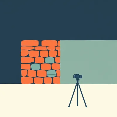
This is one of those questions where the reality is so much more interesting than the stereotype that it's almost jarring. The fine brush image — that's maybe five percent of what happens on a dig, and honestly, not even the most interesting five percent.
The brush is the archaeology equivalent of the stethoscope. It's the prop everyone pictures, but the actual work is happening somewhere else entirely.
And the somewhere else, especially here in Israel, starts before anyone puts a shovel in the ground. The Israel Antiquities Authority — the IAA — they're not just showing up after someone finds something. They have a legal mandate that any construction project, public or private, has to do a preliminary archaeological survey before they break ground. So the first thing you'd see on a modern dig isn't a brush. It's a drone.
A drone with a multispectral camera, flying a grid pattern, building a three-dimensional model of the site before anyone touches anything. And then, depending on the terrain, you might see ground-penetrating radar — GPR — being dragged across the surface. Or a magnetometer. Or electrical resistivity tomography. All of these are non-invasive. They're mapping what's underground without disturbing it. And the resolution on these things now — I saw a paper in the Journal of Archaeological Science about six months ago where they were using GPR to identify individual bricks in a wall buried two meters down.
The first phase of archaeology now is basically medical imaging for dirt.
That's exactly what it is. And the same way you don't open up a patient without a CT scan if you can avoid it, archaeologists now don't start digging until they've built a subsurface map. It changes everything about where you place your trenches, what you prioritize, what you protect.
Which also means the whole "we accidentally discovered a Roman villa while digging a parking garage" thing should theoretically be happening less.
It should, and in Israel it largely does, because the IAA's salvage archaeology system is one of the most developed in the world. Every major infrastructure project — the Tel Aviv light rail expansions, the highway interchanges, the new neighborhoods going up — they all had IAA teams on site before construction. And the volume is staggering. We're talking hundreds of salvage excavations a year. The IAA published a figure recently — over three hundred major salvage operations in a single year, and that's just the ones big enough to be classified as major.
So there's basically an archaeology-industrial complex running alongside the construction industry.
That's where the demographics question gets really interesting, because you can't staff three hundred excavations a year with five crotchety old men in khaki.
You'd need at least eight.
The field has transformed demographically in the last thirty years. Women now make up the majority of archaeology graduate students globally — in some programs it's north of sixty percent. Field directors, lab directors, specialists in archaeobotany, zooarchaeology, ceramics, metallurgy — you walk onto a dig in Israel today, the crew skews young, it's diverse, and the senior staff are as likely to be women as men. The IAA itself has had women in top leadership and field director roles for years.
The crotchety old man image is basically a twentieth-century hangover.
It's Indiana Jones. It's a movie character from nineteen eighty-one that somehow became the public's permanent mental model. And I love those movies, but they've done real damage to the public understanding of what archaeology is. Actual archaeology is collaborative, it's meticulous, it's interdisciplinary in ways that would have been unrecognizable forty years ago. You've got geophysicists working alongside pottery specialists, you've got people doing isotopic analysis of teeth to figure out where individuals grew up, you've got GIS specialists building layered digital maps, you've got conservators on site because some materials start degrading the moment they're exposed to air.
The moment you unearth something, the clock starts.
Some of those clocks are brutally short. Organic materials — textiles, wood, parchment — they can start deteriorating in hours. So you now have portable X-ray fluorescence devices on site. They look like a sci-fi ray gun, you point it at an artifact, and it tells you the elemental composition in seconds. Is this bronze or copper with arsenic? Where did the clay come from? You don't have to send it to a lab and wait three weeks. You get data in the field that shapes your next decision.
The brush has been replaced by a ray gun. This is excellent news for the coolness of archaeology.
We haven't even gotten to LiDAR yet.
Oh, let's get to LiDAR.
LiDAR — light detection and ranging — has been the single biggest revolution in landscape archaeology probably ever. You mount a LiDAR sensor on a drone or an aircraft, you fly over a site, and you fire millions of laser pulses at the ground. The sensor measures how long each pulse takes to bounce back. And here's the magic — some of those pulses hit the ground, but some hit the tops of trees, some hit branches, some hit undergrowth. You can digitally strip away the vegetation and see the bare earth surface underneath. In heavily forested areas, this has revealed entire cities that were invisible from the ground.
The Maya stuff.
The Maya stuff is the headline example. In twenty eighteen, researchers used LiDAR over the Petén region of Guatemala and found more than sixty thousand previously unknown structures — houses, causeways, defensive fortifications, agricultural terraces. An entire civilization's footprint, hidden under dense jungle canopy, revealed in a single survey. That's not digging. That's not brushes. That's a plane flying in a grid and a lot of computing power.
Sixty thousand structures. That's less like finding a needle in a haystack and more like realizing the haystack is made of needles.
LiDAR is now standard practice in Israel too. The IAA has been using it to map tells — those layered settlement mounds — and to identify features in areas that are difficult to survey on foot. The Negev, the Judean wilderness, anywhere with rough terrain. It's also been used to document sites that are at risk from erosion or development, creating a permanent digital record before they're lost.
We've got drones, multispectral cameras, ground-penetrating radar, magnetometers, XRF guns, LiDAR — this is starting to sound less like archaeology and more like a military reconnaissance operation.
The crossover is real. A lot of this technology was developed for defense applications and then adapted. Ground-penetrating radar was refined for detecting landmines and tunnels. Multispectral imaging came out of satellite reconnaissance. The same military tunnel-detection tech that's been deployed along borders is now being used to map ancient water systems and burial chambers without disturbing them.
Which brings us to the AI question. Daniel asked whether AI is showing up in the field yet.
It is, and in ways that are genuinely accelerating the work rather than just being a gimmick. The most mature application right now is in artifact classification. Pottery sherds — and I should say, the volume of pottery sherds on a typical dig is overwhelming. You might pull tens of thousands of fragments out of a single excavation season. Traditionally, a ceramics specialist would sit and classify each one by hand — rim sherds, body sherds, bases, handles, and then by ware type, by decoration, by period. It's slow, it's expensive, and it's bottlenecked by the availability of the few people who really know a region's ceramic sequence.
You train a model on known examples and it does the triage.
There's a project at the Hebrew University that's been working on exactly this — training convolutional neural networks on the IAA's massive pottery collections. The model can take a photograph of a sherd and classify it by period and type with accuracy that's competitive with human specialists. Not replacing them — but handling the initial sort, flagging the interesting or ambiguous pieces for expert review, and processing the ninety percent that are straightforward.
The AI is the triage nurse for broken pots.
The same approach is being applied to coin identification, to reading damaged inscriptions, to reconstructing fragmented texts. There's a well-known project called the Vesuvius Challenge where they used machine learning to read carbonized scrolls from Herculaneum that couldn't be physically unrolled. They trained a model to detect the faint traces of ink in CT scans of the scrolls. They're reading text that hasn't been read in two thousand years, without opening the scroll.
That's staggering. The scroll is a lump of charcoal and the AI is reading through it like it's transparent.
That's not a one-off. Similar techniques are being applied to cuneiform tablets — there are millions of them in museum collections, most untranslated, because there simply aren't enough people who can read cuneiform. AI models are now being trained to translate cuneiform directly from photographs of tablets. Not perfectly, but well enough to accelerate the work dramatically.
The AI isn't replacing the archaeologist, it's doing the thing that would have taken a human a career to do, and freeing up the human to ask the next question.
That's the pattern. And there's another application that's less flashy but maybe more consequential — predictive modeling for where to dig. If you feed a model all the known archaeological sites in a region, along with environmental data, elevation, water sources, soil types, proximity to trade routes, it can predict where undiscovered sites are likely to be. The IAA uses GIS-based predictive models to prioritize survey areas. When you've got a country the size of Israel with ten thousand years of continuous habitation, you can't survey everything. You need to know where to look.
The AI is basically saying "if I were a Bronze Age settlement, I'd be over there.
It's often right.
Let me pull on something you mentioned earlier — the salvage archaeology system. I think a lot of people don't realize that in Israel, if you want to build a house, you might end up funding an archaeological dig first. How does that actually work in practice?
The legal framework is this — any construction project, public or private, that disturbs the ground requires an opinion from the IAA. If the site is in an area of archaeological sensitivity, and huge swaths of the country are, the IAA can require a salvage excavation before building permits are issued. The developer funds it. The IAA oversees it. The work is done by IAA archaeologists or by licensed contractors who operate under IAA supervision.
You're a homeowner in Modiin, you want to add a second story, and suddenly you're paying for a dig.
More commonly with larger projects, but there are stories of people discovering they're living on top of a Second Temple period village or a Byzantine monastery, and the IAA comes in, does the excavation, documents everything, removes the significant finds, and then — in most cases — the construction proceeds. The philosophy is "preserve by record." You can't stop all development, and Israel doesn't try to. Instead, you document thoroughly, you recover what's significant, and then you let the modern world build on top.
Which creates this interesting tension where development is both the threat to archaeology and the engine that funds most of it.
And it's not unique to Israel — it's the model in much of Europe and increasingly in parts of Asia and the Americas. But Israel is an extreme case because the density of archaeological material is so high. You basically can't put a shovel in the ground in Jerusalem, in the coastal plain, in the Galilee, without hitting something.
The modern archaeologist is as much a project manager and a regulatory compliance officer as they are a scientist.
A data manager. This is the part that doesn't make it into the popular image at all. Every excavation now generates enormous amounts of digital data. The photogrammetry alone — they're taking thousands of high-resolution photographs of every square, every layer, every feature, and stitching them together into 3D models. Every artifact gets a digital record with GPS coordinates, photographs, measurements, material analysis. The data management challenge on a medium-sized dig rivals what you'd see in a mid-sized tech company.
Photogrammetry — explain that one.
You take dozens or hundreds of overlapping photographs of a feature — a wall, a floor, a burial — from different angles. Software identifies common points across the images and reconstructs the three-dimensional geometry. The result is a millimeter-accurate 3D model that you can rotate, zoom into, measure, and annotate. And because you do this every day as you excavate, you're building a time-lapse 3D record of the entire dig. By the time the excavation is done, the site has been destroyed — because excavation is destruction, you're removing layers — but you've got a complete digital replica that future researchers can re-examine.
The dig destroys itself as it proceeds, and the 3D model is the only version that persists. That's almost poetic.
It's changing how archaeology is published. Traditional excavation reports were these massive printed volumes with black-and-white photos and hand-drawn section drawings. They'd come out five, ten, fifteen years after the dig. Now, publications are increasingly digital-first, with interactive 3D models embedded, with the raw data available for other researchers to re-analyze. It's making the whole field more transparent and more reproducible.
The open-source ethos has reached archaeology.
Slowly, and with some resistance — there are old-school archaeologists who are not comfortable with sharing raw data — but the direction is clear. The younger generation expects it.
Which brings us back to who these people actually are. You mentioned the demographics shifting. What does the career path look like now? Is this still the kind of thing where you need a wealthy patron or an independent income?
That's a real question. Archaeology has historically been a field with a class problem — field schools cost money, graduate stipends are thin, and the academic job market is brutal. But the growth of cultural resource management — CRM, which is what salvage archaeology is called in most of the world — has created a parallel career track. You can work as a professional field archaeologist without being a tenure-track professor. The IAA employs hundreds of archaeologists in permanent and contract positions. Private CRM firms do the same. It's not lucrative, but it's a real profession.
You've got the academic track and the professional track, and they're increasingly overlapping.
The skill set has changed. Thirty years ago, you could be a successful field archaeologist with a good eye for stratigraphy and a strong back. Now you need to be comfortable with GIS software, with databases, with photogrammetry, with geophysical survey equipment. You don't need to be a programmer, but you need to be digitally fluent in a way that previous generations weren't.
What about the physical experience of being on a dig? Has that changed, or is it still basically "wake up at four thirty AM, dig until the heat becomes unbearable, spend the afternoon doing paperwork?
That rhythm hasn't changed much, especially in hot climates. The early start is non-negotiable — you're trying to get as much work done as possible before the sun gets high. But the afternoon has shifted. It used to be washing pottery and manual recording. Now it's data entry, it's processing photogrammetry, it's reviewing the morning's 3D scans. The physical labor is still there — someone has to move the dirt — but the ratio of physical to digital has tilted.
The dirt-moving itself — is that still done with trowels and brushes, or have we mechanized that too?
It depends on the layer. Topsoil and modern overburden — that's often removed with a backhoe, carefully, with an archaeologist watching. Once you're in archaeological layers, it's still primarily hand tools — trowels, brushes, dental picks for delicate work. But even there, the approach has changed. The trend is toward what's called "single-context recording." Instead of digging in arbitrary horizontal levels, you follow the actual archaeological deposits — each pit, each floor, each wall is excavated as its own unit, in reverse chronological order. It's more precise, it captures the relationships between features better, and it generates even more data.
The stratigraphy is the story. You're reading the site backwards through time.
Every layer is a page. The single-context method is basically saying — don't tear out pages in chunks of equal thickness. Read each page individually, in order, from the last one written to the first.
We've covered the technology, the demographics, the regulatory framework, the data management. Let me ask about something that's maybe harder to quantify. Has the interpretive framework changed? Are archaeologists asking different questions than they were fifty years ago?
Profoundly different questions. The old archaeology — the culture history approach — was mostly interested in "what happened when." It was about building chronologies, mapping the distribution of artifact types, identifying which culture was where. Starting in the nineteen sixties and seventies, processual archaeology came in and said — we need to ask "why." Why did societies shift from hunting and gathering to agriculture? Why did some settlements grow into cities and others didn't? What were the systems and processes driving change?
The shift from stamp collecting to science.
Then post-processual archaeology in the eighties and nineties pushed back and said — you can't reduce human behavior to systems and processes. Individual agency matters. You need to understand the symbolic world of past people, not just their subsistence strategies. And now the field has largely settled into a pragmatic pluralism where most archaeologists draw on multiple approaches depending on the question they're asking.
The current frontier?
A few things. One is the integration of ancient DNA — aDNA — which has revolutionized our understanding of population movements. We can now track migrations, family relationships, even individual life histories from genetic material preserved in bones and teeth. Another is isotope analysis — strontium isotopes in tooth enamel tell you where a person grew up, carbon and nitrogen isotopes tell you about their diet. You can reconstruct an individual's life trajectory from a single tooth.
A single tooth becomes a biography.
That changes how you think about the past. It's no longer just "this burial contains a male aged thirty to forty with grave goods suggesting moderate status." It's "this person was born in the hill country, moved to the coast as a child, ate a marine-heavy diet, and died in his thirties of an injury we can see in his skeleton." The specificity is completely different.
The past becomes populated with actual individuals instead of statistical categories.
That's where AI comes back in, because the amount of data you can now extract from a single skeleton — genomic, isotopic, morphological, pathological — is enormous. Integrating all of that, finding patterns across hundreds of individuals, is a machine learning problem. There are projects now using AI to reconstruct faces from skulls, to predict stature from fragmentary remains, to identify disease markers in bone scans that a human eye might miss.
Facial reconstruction from skulls — that's been around for a while in forensic contexts. How good is it now?
The AI-assisted versions are significantly better than the old manual methods. The manual approach relied heavily on the sculptor's intuition and artistic choices. The AI approach is trained on large datasets of CT scans from living populations, learning the statistical relationships between bone structure and soft tissue thickness at thousands of points across the face. It's not perfect — the ears, the nose tip, the lips — those are still partly inferential. But the overall facial architecture is much more data-driven than it used to be.
You can look at a face that hasn't been seen in three thousand years, and it's not an artist's guess, it's a statistical prediction.
With error bars. And the error bars are published alongside the reconstruction, which is itself a cultural shift. The old reconstructions were presented as "this is what she looked like." The new ones are presented as "this is the most probable facial morphology given the skeletal evidence, with these specific areas of uncertainty.
Intellectual humility in facial reconstruction. What a time to be alive.
The whole field has gotten more comfortable with uncertainty, actually. The old model was the authoritative expert who declared what happened. The new model is more probabilistic, more transparent about what's inferred versus what's directly evidenced. It's a healthier epistemology.
Let me ask about something that's maybe more specific to Israel. You mentioned the density of archaeological material. Does that create a kind of triage problem where you have to decide what to preserve and what to let go?
And it's one of the hardest parts of the job. You can't preserve everything. In a place like Jerusalem, where every square meter has multiple layers of significant occupation, you're making decisions all the time about what gets fully excavated and documented, what gets preserved in situ, what gets removed to a warehouse, and what gets documented and then covered over by a new building's foundation.
Those decisions are not purely scientific. They're political, they're religious, they're economic.
Of course they are. Archaeology in Israel exists in a highly charged environment. Different communities have different relationships to the material past. The IAA has to navigate that constantly. And the salvage excavation system, for all its efficiency, is not immune to those pressures. There are cases where the timeline is accelerated because a developer is pushing, or where a significant find creates a conflict between preservation and construction that ends up in the courts.
The archaeologist as mediator between the past and the present, with a backhoe idling in the background.
That's not far from the reality. And it's why the romantic image of the solitary scholar with a brush is not just outdated — it's almost the opposite of what the job actually entails. Modern archaeology is deeply social. It's negotiating with developers, managing crews, collaborating across disciplines, engaging with communities, navigating regulatory frameworks, communicating findings to the public.
The brush was a solo instrument. The LiDAR drone is an ensemble piece.
The ensemble keeps getting larger. One thing I haven't mentioned is community archaeology — the trend toward involving local communities in excavation and interpretation. In Israel, there are programs that bring school groups to digs, that involve local residents in site conservation, that work with communities to decide what stories get told about the material that's uncovered.
The public isn't just the audience for the museum exhibit at the end. They're involved in the process.
That changes the power dynamics. The old model was — archaeologists come in, dig up your ancestors, take the good stuff to a museum, publish in journals you can't access, and leave. The new model, at its best, is more collaborative. It recognizes that local communities have a stake in their own material heritage.
Does that actually work in practice, or is it more aspirational?
It's uneven. There are projects that do it well, and there are projects that still operate in the old extractive mode. But the trend is real, and the younger generation of archaeologists is much more committed to collaborative models than their predecessors were.
To circle back to Daniel's original question — if you walked onto a typical IAA dig tomorrow, what would you actually see?
You'd see a mixed-age, mixed-gender crew, probably skewed toward people in their twenties and thirties. You'd see a drone overhead and a total station — a surveying instrument — set up at the edge of the site. You'd see people with tablets, not clipboards, recording data directly into a GIS-linked database. You'd see photogrammetry setups — cameras on poles, photographing each excavation unit from multiple angles. You'd see the physical work — trowels, buckets, wheelbarrows — still happening, because the dirt still has to move. But you'd also see a lot of screens.
The dirt and the data, side by side.
You'd see specialists rotating through — the zooarchaeologist looking at animal bones, the paleobotanist taking soil samples for flotation to recover seeds and pollen, the conservator stabilizing fragile finds, the surveyor checking the grid. It's a surprisingly industrial operation. A well-run dig has the feel of a coordinated team effort, not a solitary pursuit.
The fine brush exists, but it's one tool among dozens, and probably not the most important one.
The fine brush is for the last five millimeters. The first five meters — that's geophysics, heavy equipment, and digital survey. The brush gets the glamour shot, but the real work is everything that happens before the brush comes out.
The brush is the archaeology equivalent of the courtroom sketch artist. It's what the public pictures, but it's not where the action is.
The crotchety old man — I mean, he exists. There are senior scholars who fit that description. But he's not the field. He's a retiree in a department somewhere, and the actual work is being done by people who look nothing like him.
The crotchety old man has been promoted to emeritus and the dig is being run by a thirty-five-year-old woman with a PhD in geophysics and a drone license.
She's probably better at it.
The stereotype is not just wrong, it's wrong in a way that obscures how much more interesting the reality is.
That's the thing about stereotypes — they're not just inaccurate, they're boring. The actual practice of archaeology in two thousand twenty-six is more technologically sophisticated, more collaborative, more data-intensive, and more diverse than the popular image allows. And AI is not some distant future for the field — it's already in use, in artifact classification, in predictive modeling, in text reconstruction, in facial reconstruction. It's not replacing archaeologists. It's giving them tools to ask questions that were previously unanswerable.
The unreadable scroll is now readable. The invisible city is now visible. The anonymous skeleton now has a face and a life story.
All of that is happening alongside the regulatory machinery that processes hundreds of salvage excavations a year, generating terabytes of data, most of which will be studied for decades after the dig is backfilled and a new apartment building stands on the site.
The dig is temporary. The data is permanent. That's the modern archaeology trade-off in one sentence.
That's why the data management piece matters so much. If the excavation report sits on a shelf for fifteen years and then comes out as a PDF with low-resolution photos, you've failed. The goal now is to create a digital record that's so rich and so well-structured that someone fifty years from now can re-examine your evidence and reach their own conclusions.
Archaeology as a commitment to future researchers you'll never meet.
That's the ethic. And it's one of the things that makes me optimistic about the field. For all the pressure, for all the politics, there's a genuine commitment to doing the work carefully and leaving a record that outlasts you.
I think we've thoroughly dismantled the brush-and-khaki image. Should we do the fun fact?
Let's do it.
Now — Hilbert's daily fun fact.
Hilbert: In the nineteen hundreds, explorers in the Gobi Desert occasionally stumbled across fulgurites — hollow glass tubes formed when lightning strikes sand. The name comes from the Latin "fulgur," meaning lightning, which is also the root of "fulgurate," a medical term for destroying tissue with electric current. So the same word family gave us both desert lightning-glass and a surgical technique.
Lightning glass and electrocautery, same Latin root.
To close this out — if someone's listening and thinking archaeology might be for them, what should they know?
That it's not what the movies show. It's harder, more technical, more collaborative, and more interesting. You don't need to be an old man with a brush. You can be anyone with curiosity, patience, and a willingness to learn tools that didn't exist when the old guard was trained. And the field needs people who can bridge the science and the humanities — who are as comfortable with a database as with a trowel.
If you're in Israel and you're building a house — maybe budget for a salvage dig.
It's not the worst thing to have an archaeologist in your backyard. You might learn something extraordinary about the ground you live on.
Thanks to our producer Hilbert Flumingtop for the fun facts and the production work. This has been My Weird Prompts. Find us at myweirdprompts.com or wherever you get your podcasts. We'll be back soon.

")